Garmin Colorado 300
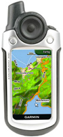 | Outdated Product Hiking GPS navigator for tourism lovers. The device has a relatively large colour screen with a diagonal of 3 "and a resolution of 400x240 pixels. A completely waterproof case allows you to use it in any field conditions, and the backlight of the screen allows you to use it at night. The navigator supports the function of downloading maps, for this you can use the USB interface .USB cable included. |
We recommend products in stockSat Navs Garmin →

handheld, 3 ", memory 4 GB, Wi-Fi, ANT+, water protection IPX7, up to 40 hours of work, 272 g

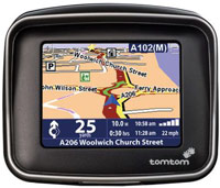
motorcycle, 3.4 ", memory 16 GB, Live Traffic, Wi-Fi, water protection IPX7, up to 6 hours of work, 280 g
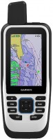
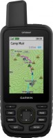
handheld, 3 ", memory 8 GB, water protection IPX7, non chargeable batteries, up to 19 hours of work, 282 g
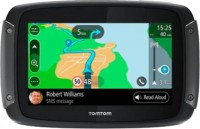
motorcycle, 3.4 ", memory 16 GB, map update, Live Traffic, Wi-Fi, water protection IPX7, up to 6 hours of work, 280 g
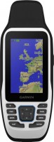
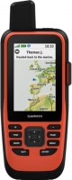
handheld, 3 ", memory 16 GB, Wi-Fi, ANT+, water protection IPX7, up to 180 hours of work, 230 g

handheld, 3 ", memory 16 GB, Wi-Fi, ANT+, water protection IPX7, up to 180 hours of work, 230 g
handheld, 3 ", memory 4 GB, Wi-Fi, ANT+, water protection IPX7, up to 18 hours of work, 272 g

handheld, 3.5 ", memory 16 GB, Wi-Fi, ANT+, water protection IPX7, up to 55 hours of work, 280 g
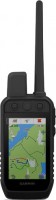
handheld, 3.5 ", memory 16 GB, Wi-Fi, ANT+, water protection IPX7, up to 55 hours of work, 280 g
Garmin Colorado 300
Type:handheld
Screen size:3 "
Resolution:400х240 px
Power supply:non chargeable battery
Working hours:up to 15 h
Weight:207 g
Hiking GPS navigator for tourism lovers. The device has a relatively large colour screen with a diagonal of 3 "and a resolution of 400x240 pixels. A completely waterproof case allows you to use it in any field conditions, and the backlight of the screen allows you to use it at night. The navigator supports the function of downloading maps, for this you can use the USB interface .USB cable included.
All specifications
Specifications Colorado 300
|
| |||||||||||||||||||||||||||||||||||||||||||||||||||||||||||||
The information in the model description is for reference purposes.
Always clarify the specifications and configuration of the product with the online store manager before purchasing.
Catalog Garmin 2026 - new arrivals, bestsellers, and the most relevant models Garmin.
Always clarify the specifications and configuration of the product with the online store manager before purchasing.
Catalog Garmin 2026 - new arrivals, bestsellers, and the most relevant models Garmin.
Additional features sat nav Garmin Colorado 300:
WAAS technology
WAAS (Wide Area Augmentation System) is a system designed to increase the accuracy of satellite navigation instruments. The principle of operation of the system is based on the correction of satellite data using special corrections, which are calculated by base stations installed in the service area of the system.
- WAAS technology
- Geocaching Mode
- Possibility to update the firmware
- Area calculation
- Tide tables
- Hunter/fisher calendar
- Sunrise/sunset and moon phase information
- Electronic compass
- Barometric altimeter (altimeter)
- USB cable
- Carbine
- MapSource Trip & Waypoint Manager Software
- Brief instruction
- User guide
WAAS technology
WAAS (Wide Area Augmentation System) is a system designed to increase the accuracy of satellite navigation instruments. The principle of operation of the system is based on the correction of satellite data using special corrections, which are calculated by base stations installed in the service area of the system.