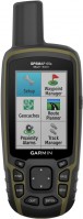
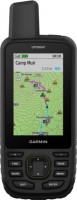
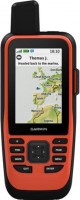
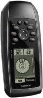
Garmin GPSMAP 78S
 | Expecting restock Wearable all-weather GPS navigator. A convenient strap is attached to the case, for wearing on the arm. The device is very economical, one set of two AA batteries is enough for at least 20 hours of continuous operation. True, if you use a magnetic compass or at night you need a screen backlight, then the operating time can be significantly reduced. Additional options include a barometric altimeter. The case is protected from moisture. |
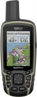
Garmin GPSMAP 78S
Type:handheld
Screen size:2.6 "
Resolution:160х240 px
Power supply:non chargeable battery
Working hours:up to 20 h
Weight:218 g
Wearable all-weather GPS navigator. A convenient strap is attached to the case, for wearing on the arm. The device is very economical, one set of two AA batteries is enough for at least 20 hours of continuous operation. True, if you use a magnetic compass or at night you need a screen backlight, then the operating time can be significantly reduced. Additional options include a barometric altimeter. The case is protected from moisture.
All specifications
Specifications GPSMAP 78S
|
| |||||||||||||||||||||||||||||||||||||||||||||||||||||||
The information in the model description is for reference purposes.
Always clarify the specifications and configuration of the product with the online store manager before purchasing.
Catalog Garmin 2026 - new arrivals, bestsellers, and the most relevant models Garmin.
Always clarify the specifications and configuration of the product with the online store manager before purchasing.
Catalog Garmin 2026 - new arrivals, bestsellers, and the most relevant models Garmin.
Series Garmin GPSMAP (tracking)Compare using chart →
handheld, 2.6 ", memory 16 GB, ANT+, water protection IPX7, non chargeable batteries, up to 16 hours of work, 217 g
handheld, 3 ", memory 4 GB, Wi-Fi, ANT+, water protection IPX7, up to 40 hours of work, 272 g
handheld, 2.6 ", memory 16 GB, ANT+, water protection IPX7, non chargeable batteries, up to 16 hours of work, 217 g
handheld, 3 ", memory 8 GB, water protection IPX7, non chargeable batteries, up to 19 hours of work, 282 g
handheld, 3 ", memory 16 GB, Wi-Fi, ANT+, water protection IPX7, up to 180 hours of work, 230 g
handheld, 3 ", memory 4 GB, Wi-Fi, ANT+, water protection IPX7, up to 18 hours of work, 272 g
handheld, 2.6 ", water protection IPX7, non chargeable batteries, up to 18 hours of work, 203 g
Model overview based on user reviews
The Garmin GPSMAP 78S is a robust GPS navigator designed for outdoor enthusiasts, offering excellent signal reception and high-quality pre-installed maps, including a map of Ukraine. It features a highly sensitive GPS receiver that accurately determines coordinates, a built-in tilt-compensated 3-axis electronic compass, and a barometric altimeter. The device is water-resistant to IPX7 standards, allowing it to float and function in water, though it should not be submerged deeply. It operates on two AA batteries, providing up to 20 hours of use. However, it lacks GLONASS support, has a small and dim screen, and is considered expensive. Despite these drawbacks, it is praised for its functionality and durability, making it a great choice for tourists and adventurers.
Pros
Cons
I love tourism, long hikes, and everything related to them. In recent years, I've developed a passion for "water trips" in kayaks. I have like-minded friends, and the time we spend in nature together is the best active leisure I can imagine. Unfortunately, my wife does not share my enthusiasm, but she is understanding about it. This navigator was her gift to me for my birthday, and I must say, it turned out to be an excellent present. She once heard in a conversation that such a device was needed and made an effort to find the most versatile, all-weather, and durable device. It already has high-quality pre-installed maps, including a map of Ukraine. The functionality for the tourist is simply fabulous. Thanks to the highly sensitive GPS-receiver determines the coordinates quickly and very accurately. It has a built-in tilt-compensated 3-axis electronic compass and a barometric altimeter. It can quite accurately determine the distance traveled, measures the speed of movement, and can calculate the height of the ascent and descent. Has excellent protection against water according to the IPX7 standard. Why is there protection, it can be thrown into the water, where it will swim and continue to work quietly. The only thing you definitely shouldn’t do with it is immerse it to a noticeable depth. It's not designed for water pressure though. Very economically consumes the charge of batteries (two finger-type, AA format), which is enough for almost a day of continuous operation. And if the batteries are discharged, they can be replaced with any compatible batteries (preferably alkaline). Does not work with Glonass satellites. The screen is small and dim. It looks unpresentable in the sun, but at least it is readable and that's good. The weight is significant. Very high cost. Thanks to my wife (she earns decently), I myself would hardly have spent so much on such a device. |
Add Review
Video reviews

Garmin GPSMAP 78sc Marine Handheld GPS - West Marine Quick Look
3 January 201890 263 view

Garmin 78sc Review
17 November 201923 570 view
Garmin GPSMAP 78s Unboxing HD (010-00864-01)
22 May 20186 324 view
Garmin GPSMAP 78s
18 April 20201 181 view
Additional features sat nav Garmin GPSMAP 78S:
- Hunter/Angler Calendar
- Sunrise and sunset information and moon phases
- Tide Table
- Area calculation
- Photo navigation
- Garmin GPSMAP 78s — 3-axis electronic compass with tilt compensation; barometric altimeter (altimeter); data transfer between similar devices.
- Wrist strap
- USB cable
We recommendCompare using chart →
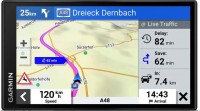
cars, 6 ", memory 32 GB, Live Traffic, Lane Guidance, GPS informer, GSM/GPRS, Wi-Fi, up to 1 hours of work
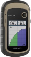
handheld, 1 ", ANT+, water protection IPX7, battery 1250 mAh, up to 96 hours of work, 100 g
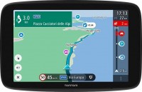
cars, 6 ", memory 16 GB, Live Traffic, Lane Guidance, Wi-Fi, magnetic mount, up to 1 hours of work
handheld, 2.6 ", memory 16 GB, ANT+, water protection IPX7, non chargeable batteries, up to 16 hours of work, 217 g
cars, 6 ", memory 16 GB, map update, Live Traffic, Lane Guidance, Wi-Fi, up to 1 hours of work, 175 g
handheld, 2.2 ", memory 8 GB, ANT+, water protection IPX7, non chargeable batteries, up to 25 hours of work, 142 g

cars, 6 ", memory 32 GB, Live Traffic, Lane Guidance, Wi-Fi, magnetic mount, up to 1 hours of work

cars, 7 ", memory 32 GB, Live Traffic, Lane Guidance, Wi-Fi, magnetic mount, up to 1 hours of work

campers, 7 ", memory 32 GB, map update, Live Traffic, Lane Guidance, GPS informer, Wi-Fi, up to 1 hours of work

