Garmin GPS 60
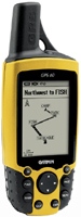 | Expecting restock Universal GPS navigator for hiking. From one set of batteries (2 pcs. AA) the navigator can work up to 28 hours. Thanks to the waterproof design of the case, the device can be used fearlessly in the most adverse weather conditions. If necessary, you can load the necessary maps of the area into the device, the navigator supports this function. For this, a USB interface or COM port will help. |
Garmin GPS 60
Type:handheld
Screen size:2.7 "
Resolution:160х240 px
Power supply:non chargeable battery
Working hours:up to 28 h
Weight:198 g
Universal GPS navigator for hiking. From one set of batteries (2 pcs. AA) the navigator can work up to 28 hours. Thanks to the waterproof design of the case, the device can be used fearlessly in the most adverse weather conditions. If necessary, you can load the necessary maps of the area into the device, the navigator supports this function. For this, a USB interface or COM port will help.
All specifications
Specifications GPS 60
|
| |||||||||||||||||||||||||||||||||||||||||||||||||||
The information in the model description is for reference purposes.
Always clarify the specifications and configuration of the product with the online store manager before purchasing.
Catalog Garmin 2026 - new arrivals, bestsellers, and the most relevant models Garmin.
Always clarify the specifications and configuration of the product with the online store manager before purchasing.
Catalog Garmin 2026 - new arrivals, bestsellers, and the most relevant models Garmin.
Additional features sat nav Garmin GPS 60:
The Garmin GPS 60 GPS navigator includes 1 MB of internal memory for storing POIs. The device comes with a downloaded database containing the main cities of the world. You can select a destination and the GPS 60 will create a straight-line route to that point. In addition, this device includes special functions for geocaching, outdoor and indoor games, alarm clock, tables with sunrise/sunset/moon time and moon phases, information about the optimal time for hunting and fishing, and much more.
Good to know:
WAAS technology
WAAS (Wide Area Augmentation System) is a system designed to increase the accuracy of satellite navigation instruments. The principle of operation of the system is based on the correction of satellite data with the help of special corrections, which are calculated by base stations installed in the service area of the system.
- WAAS technology
- Geocaching Mode
- Possibility to update the firmware
- Hunter/fisher calendar
- Sunrise/sunset and moon phase information
- Built-in GPS games
- Area calculation
- Strap
- USB cable
- Belt clip with button
- MapSource® Trip & Waypoint Manager CD
- Brief instruction
- User guide
- Garmin GPS 60 — built-in memory — 1 MB, no route calculation function
- Garmin GPSMAP 60 — 24 MB built-in memory, route calculation function
The Garmin GPS 60 GPS navigator includes 1 MB of internal memory for storing POIs. The device comes with a downloaded database containing the main cities of the world. You can select a destination and the GPS 60 will create a straight-line route to that point. In addition, this device includes special functions for geocaching, outdoor and indoor games, alarm clock, tables with sunrise/sunset/moon time and moon phases, information about the optimal time for hunting and fishing, and much more.
Good to know:
WAAS technology
WAAS (Wide Area Augmentation System) is a system designed to increase the accuracy of satellite navigation instruments. The principle of operation of the system is based on the correction of satellite data with the help of special corrections, which are calculated by base stations installed in the service area of the system.
We recommendCompare using chart →
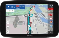
cars, 6 ", memory 32 GB, Live Traffic, Lane Guidance, GPS informer, GSM/GPRS, Wi-Fi, up to 1 hours of work
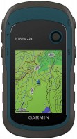
handheld, 2.2 ", memory 8 GB, water protection IPX7, non chargeable batteries, up to 25 hours of work, 142 g
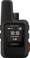
handheld, 1 ", ANT+, water protection IPX7, battery 1250 mAh, up to 96 hours of work, 100 g
cars, 6 ", memory 16 GB, Live Traffic, Lane Guidance, Wi-Fi, magnetic mount, up to 1 hours of work
handheld, 2.6 ", memory 16 GB, ANT+, water protection IPX7, non chargeable batteries, up to 16 hours of work, 217 g
cars, 6 ", memory 16 GB, map update, Live Traffic, Lane Guidance, Wi-Fi, up to 1 hours of work, 175 g
handheld, 2.2 ", memory 8 GB, ANT+, water protection IPX7, non chargeable batteries, up to 25 hours of work, 142 g

cars, 6 ", memory 32 GB, Live Traffic, Lane Guidance, Wi-Fi, magnetic mount, up to 1 hours of work

cars, 7 ", memory 32 GB, Live Traffic, Lane Guidance, Wi-Fi, magnetic mount, up to 1 hours of work

campers, 7 ", memory 32 GB, map update, Live Traffic, Lane Guidance, GPS informer, Wi-Fi, up to 1 hours of work
