Lowrance iFinder Expedition C
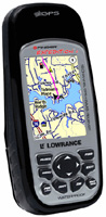 | Outdated Product Hiking portable GPS receiver with WAAS support. This useful technology can significantly improve the accuracy of positioning on the ground. The case of the device is reliably protected from dust and moisture, so that it can be used even in the most adverse weather. The 2.8" colour screen with a resolution of 320x240 pixels is backlit so that this navigator can be used even in complete darkness. One set of two AA batteries will last for 14 hours of operation. |
We recommend products in stockSat Navs Lowrance →
handheld, 2.6 ", water protection IPX7, non chargeable batteries, up to 18 hours of work, 203 g
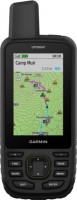
handheld, 3 ", memory 8 GB, water protection IPX7, non chargeable batteries, up to 19 hours of work, 282 g

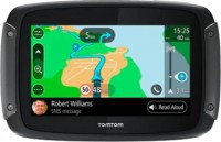
motorcycle, 3.4 ", memory 16 GB, Live Traffic, Wi-Fi, water protection IPX7, up to 6 hours of work, 280 g
handheld, 2.6 ", memory 16 GB, ANT+, water protection IPX7, non chargeable batteries, up to 16 hours of work, 217 g
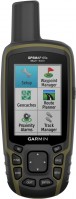
handheld, 2.6 ", memory 16 GB, ANT+, water protection IPX7, non chargeable batteries, up to 16 hours of work, 217 g


handheld, 2.6 ", water protection IPX7, non chargeable batteries, up to 20 hours of work, 218 g
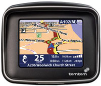
motorcycle, 3.4 ", memory 16 GB, map update, Live Traffic, Wi-Fi, water protection IPX7, up to 6 hours of work, 280 g
handheld, 3 ", memory 16 GB, Wi-Fi, ANT+, water protection IPX7, up to 180 hours of work, 230 g

handheld, 3.5 ", memory 16 GB, Wi-Fi, ANT+, water protection IPX7, up to 55 hours of work, 280 g
handheld, 3.5 ", memory 16 GB, Wi-Fi, ANT+, water protection IPX7, up to 55 hours of work, 280 g
Lowrance iFinder Expedition C
Type:handheld
Screen size:2.8 "
Resolution:320х240 px
Power supply:non chargeable battery
Working hours:up to 14 h
Weight:247 g
Hiking portable GPS receiver with WAAS support. This useful technology can significantly improve the accuracy of positioning on the ground. The case of the device is reliably protected from dust and moisture, so that it can be used even in the most adverse weather. The 2.8" colour screen with a resolution of 320x240 pixels is backlit so that this navigator can be used even in complete darkness. One set of two AA batteries will last for 14 hours of operation.
All specifications
Specifications iFinder Expedition C
|
| |||||||||||||||||||||||||||||||||||||||||||||||||||||||||||
The information in the model description is for reference purposes.
Always clarify the specifications and configuration of the product with the online store manager before purchasing.
Catalog Lowrance 2026 - new arrivals, bestsellers, and the most relevant models Lowrance.
Always clarify the specifications and configuration of the product with the online store manager before purchasing.
Catalog Lowrance 2026 - new arrivals, bestsellers, and the most relevant models Lowrance.
Good to know:
WAAS technology
WAAS (Wide Area Augmentation System) is a system designed to increase the accuracy of satellite navigation instruments. The principle of operation of the system is based on the correction of satellite data with the help of special corrections, which are calculated by base stations installed in the service area of the system.