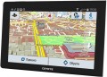
Display
Parameters of the display installed in the navigator.
— Display diagonal. Size screen size in inches. The larger the screen, the more information can be displayed on it and the more detailed this information will be presented. On the other hand, the size of the display significantly affects the dimensions of the device, and large screens are more expensive.
— Display resolution. Display size in dots (pixels) horizontally and vertically. The higher the resolution (with the same diagonal), the more detailed and clear the image the screen can produce. In addition, on high-resolution displays, small details are better visible, which increases the comfort of viewing information. Too high a resolution is usually not required for GPS navigator displays: for example, 800x480 pixels, limited by the standards of smartphones or tablets, with a diagonal screen size of about 6” are considered quite sufficient even for an advanced device.
— Matrix type. This parameter is indicated mainly for tech cases when the screen uses a high-quality
IPS type matrix. This technology provides high quality color rendering, good brightness and wide viewing angles; moreover, IPS screens are relatively inexpensive to produce.
- Touch. Screen support for touch control. You can give commands to the device by touching the icons on the display itself - similar to how this is done in smartphones and tablets. Touch control opens up
...many more possibilities than classic controls and provides flexibility in working with the navigator. In particular, by touching the screen you can set points on the route, zoom in or out on the map, etc.
- Color. This parameter determines whether the screen is color or monochrome (black and white). Black and white displays are simple, inexpensive, consume little power, and are quite suitable for displaying basic navigation information. At the same time, color screens are more functional: maps often use different colors to highlight individual objects, which would not be possible on monochrome displays. As a result, black and white screens are quite rare among modern navigators - mainly among the most compact and inexpensive models.
— Backlight. The screen has its own backlight system. This function makes the device independent of external lighting: the illuminated image will be normally visible both at dusk and even in complete darkness. It is also worth noting that many LCD screens have a backlight by default; it is activated when the screen itself is turned on and works regardless of external lighting - without it, the image on the matrix would simply be impossible to see. In particular, this operating principle is used in IPS-type matrices, which have gained popularity in modern portable electronics (including navigators).Video resolution
Resolution of the video recorded by the
built-in video recorder of the navigator
The higher the video resolution, other things being equal, the more detailed the video is, the better you can see the small details of what is happening on it. This is especially important when analyzing traffic accidents or ambiguous situations, as well as identifying people, fixing car numbers, etc. On the other hand, higher resolution requires more powerful hardware and more capacious drives for storing footage — all this has a corresponding effect on the price of the device.
Field of view
Viewing angle of the built-in video recorder installed in the navigator.
The size of the space covered by the camera directly depends on the viewing angle: the wider the angle, the larger the size of the area that enters the frame, and the less likely it is to miss an object or event located on the periphery of the frame. On the other hand, ceteris paribus, an increase in the viewing angle gives the effect of reducing the picture — individual details look smaller and are less clearly visible. And at too wide angles, noticeable distortions appear on the edges of the image.
Speaking about the specific values of the angles, it is worth noting that the minimum indicator found among the registrars is about 50 ° — this is comparable to the field of view and the degree of magnification of the human eye (excluding side vision). The maximum viewing angle can theoretically reach 180°, however, in fact, navigators use cameras with more modest characteristics — mainly up to 120°.
More features
—
GSM/GPRS module. Built-in wireless cellular module, similar to those found in GSM mobile phones. However, unlike phones, in GPS navigators this communication is intended solely for Internet access. Most often it is used to obtain information about traffic jams, although some advanced models may provide the ability to fully view Internet pages through the built-in browser. To use the GSM/GPRS module, as in the case of a mobile phone, you need to purchase a SIM card from a mobile operator.
—
Digital camera. The navigator has its own digital camera; in some models there may even be two such cameras, on both sides of the body. The specific functionality of a digital camera(s) may vary depending on the capabilities of the device itself. Thus, most models with a DVR function use a built-in camera (for more details, see “Built-in DVR”). If you have a telephone module (see the corresponding paragraph), the camera can be useful for video communication. Many navigators with this function can also be used for classic photo/video shooting; The image quality, however, is usually relatively low.
—
Video player. Ability to use the navigator to play video files. As a rule, we are talking about playing video on your own display - accordingly, the display itself is made in color and quite large for this purpose. This function is found mainly among car navigators (see “Sc
...ope”), it is especially appreciated by drivers who have to spend a lot of time waiting - in particular, taxi drivers and truck drivers.
- Voice control. The ability to control the navigator using voice commands. This feature is especially convenient for automobile and motorcycle devices: it allows you to control the device without taking your hands off the controls and without taking your eyes off the road. However, before purchasing such a model, it would not hurt to clarify which languages it supports for voice control.
— Playback images. Ability to use the navigator screen to view graphic files; By default, JPG support is implied; other graphic formats are somewhat less common. A navigator with this function can be used as a digital photo frame - connect an external storage device and view pictures directly, without the participation of a computer. This function can be useful, for example, for viewing photos taken during a trip (when you don’t want to wait to get back to the computer), or for more specific purposes - for example, clarifying navigation data from a scan of a paper map.
— MP3 player. The ability to play audio files with the navigator (most often in MP3 format, hence the name). Playback can occur through headphones or an external audio system (if it is possible to connect them) or through the navigator’s own speaker. Such files can be stored in the device’s own flash memory or on removable memory cards.
— FM transmitter. Low-power FM transmitter with an effective range of several meters. It is one of the simplest ways to connect a navigator to a car's speaker system - just tune the FM receiver of the car radio to the frequency of the transmitter. In this way, you can use the car speakers, for example, to play voice prompts, music (see MP3 player) or the soundtrack of a movie being played (see Video player).
— Barometer. An auxiliary function that allows you to measure atmospheric pressure. It is often used as an additional tool in navigators with the function of measuring altitude using signals from satellites - this ensures increased accuracy of the received data. In addition, data from the barometer can be useful in forecasting the weather for the near future: for example, a sharp drop in pressure usually means worsening weather - even a storm or even a hurricane.RAM
The amount of random access memory (RAM) installed in the navigator.
The amount of RAM is one of the key parameters of any computer system, directly affecting its performance and computing power. The more RAM installed on board, the better the device will cope with resource-intensive tasks and the more applications you can run on it without noticeable damage to the speed of operation.
Specifically in navigators, performance can be important, for example, when driving at high speed - the “braking” device may be late with a hint, which causes various unpleasant situations to arise. At the same time, paying attention to the amount of RAM only makes sense if an operating system like Android is installed on board.
Built-in memory
The amount of built-in memory installed in the navigator.
The amount of data that can be stored in the device directly depends on this indicator. However, it is worth keeping in mind that, on the one hand, a certain amount of built-in memory will inevitably be occupied by the operating system (if there is one), firmware and other programs supplied in the kit; on the other hand, the set of these programs in most cases also includes a preinstalled card. The latter means that the navigator can be used for its intended purpose “out of the box” without installing additional software; and for such an application the built-in memory is guaranteed to be enough. This means that it makes sense to pay attention to the storage capacity primarily if the device will have to work with additional data - from extended maps to photos and videos. This is especially true for models with a full-fledged OS like Windows or Android, which allows the installation of additional applications.
Max. memory card / flash drive size
The maximum size of a memory card or USB-drive (flash drive) supported by the navigator.
Removable media can be used for different purposes: downloading maps and software updates, uploading tracks you have covered, playing or copying music and movies (in models with the appropriate capabilities), etc. Specific options for using such media for each model should be clarified separately. And the restrictions on volume are primarily due to the fact that more capacious memory cards and flash drives require more powerful hardware. So you should not exceed this limit: at best, the drive will not work correctly, at worst, hardware failures are possible.