Pre-installed soft
The navigation programme, originally installed in the navigator and sold with it, in other words, a set of maps available to the user “out of the box”.
Most modern navigators are equipped with such programs (although the name of pre-installed maps is not indicated for all models). Note that the functionality of complete programs in different models may vary. Most often, these are the simplest maps of the world or the region in which this device is sold. However, there are exceptions: there are models with detailed maps, programs with advanced functionality, etc. Such exceptions are especially common among high-end specialized devices, in particular marine and aviation (see "Scope"). And for some navigators, there may be several options for pre-installed programs and even the ability to select such programs at the request of the user. All these details should be specified in each case according to the manufacturer or seller.
It is also worth considering that the characteristics often indicate only the general name of the cards. At the same time, the same card can be available in several versions that differ in functionality and, sometimes, terms of use (paid / free). However, the main features are basic capabilities, interface device, etc. — usually, are common to all versions. Therefore, by the name of the complete programme, usually, one can quite accurately determine the general capabilities and features of the card's functionality.
Map coverage
The region of the world for which map data is available on your navigation device. Map coverage determines which geographic areas and countries can be displayed and used for navigation on a specific device. Note that coverage may vary in detail and content: some preset maps may contain detailed information about roads, landmarks, shops, gas stations and the like on a global scale, while others are often limited to the basic road network for a particular country or region .
To make it easier to find a suitable solution for map coverage, registrars can be divided into several subcategories based on territoriality:
Europe,
Africa,
the whole world.
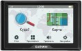
Display
Parameters of the display installed in the navigator.
— Display diagonal. Size screen size in inches. The larger the screen, the more information can be displayed on it and the more detailed this information will be presented. On the other hand, the size of the display significantly affects the dimensions of the device, and large screens are more expensive.
— Display resolution. Display size in dots (pixels) horizontally and vertically. The higher the resolution (with the same diagonal), the more detailed and clear the image the screen can produce. In addition, on high-resolution displays, small details are better visible, which increases the comfort of viewing information. Too high a resolution is usually not required for GPS navigator displays: for example, 800x480 pixels, limited by the standards of smartphones or tablets, with a diagonal screen size of about 6” are considered quite sufficient even for an advanced device.
— Matrix type. This parameter is indicated mainly for tech cases when the screen uses a high-quality
IPS type matrix. This technology provides high quality color rendering, good brightness and wide viewing angles; moreover, IPS screens are relatively inexpensive to produce.
- Touch. Screen support for touch control. You can give commands to the device by touching the icons on the display itself - similar to how this is done in smartphones and tablets. Touch control opens up
...many more possibilities than classic controls and provides flexibility in working with the navigator. In particular, by touching the screen you can set points on the route, zoom in or out on the map, etc.
- Color. This parameter determines whether the screen is color or monochrome (black and white). Black and white displays are simple, inexpensive, consume little power, and are quite suitable for displaying basic navigation information. At the same time, color screens are more functional: maps often use different colors to highlight individual objects, which would not be possible on monochrome displays. As a result, black and white screens are quite rare among modern navigators - mainly among the most compact and inexpensive models.
— Backlight. The screen has its own backlight system. This function makes the device independent of external lighting: the illuminated image will be normally visible both at dusk and even in complete darkness. It is also worth noting that many LCD screens have a backlight by default; it is activated when the screen itself is turned on and works regardless of external lighting - without it, the image on the matrix would simply be impossible to see. In particular, this operating principle is used in IPS-type matrices, which have gained popularity in modern portable electronics (including navigators).