Comparison StarLine M18 Pro vs Jimi JM01
Add to comparison | 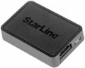 | 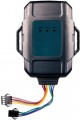 |
|---|---|---|
| StarLine M18 Pro | Jimi JM01 | |
| Outdated Product | Outdated Product | |
| TOP sellers | ||
Possibility of use with on-board network voltage 12V and 24V. | ||
| Main function | for vehicles | for vehicles |
Navigation and GSM | ||
| Positioning accuracy | 10 m | 10 m |
| GPS channels | 66 | |
| Hot start | 2 с | 2 с |
| Cold start | 35 с | |
| GSM band | 900/1800 MHz | 850/900/1800/1900 MHz |
| Positioning | aGPS GLONASS | |
Functions and sensors | ||
| Notifications features | SMS SOS alerts ignition on tracker power off geofence | SMS SOS alerts ignition on tracker power off geofence |
| Functions | power / fuel relay motion sensor (gyroscope) tilt sensor built-in microphone | power / fuel relay motion sensor (gyroscope) tilt sensor |
General | ||
| Built-in memory | 64 MB | |
| Fastening | without mount | bolt-on |
| Battery capacity | 2600 mAh | 800 mAh |
| Dust-, waterproof | IP65 | |
| Dimensions | 64x44x13.5 mm | 87x74x18.7 mm |
| Weight | 33 g | 94 g |
| Added to E-Catalog | may 2019 | june 2017 |
Compare StarLine M18 Pro and Jimi JM01
You may be interested in
StarLine M18 Pro often compared


Glossary
GPS channels
The number of GPS channels supported by the tracker. In fact, this is the number of navigation signals that the device can simultaneously receive.
Note that the number of channels is not just the number of satellites that the device can “see” at the same time. From a point on the Earth's surface, about 20 navigation satellites are simultaneously visible (9 – 10 GPS and the same number of GLONASS); in this case, the number of channels in the receiver can be noticeably larger. This is done taking into account the fact that modern navigation chipsets are able to process not only direct, but also reflected (from walls, trees, etc.) signals, thereby increasing the speed and accuracy of work. Accordingly, the more channels — the more advanced the device is, the wider its capabilities for processing reflected signals, all other things being equal.
Note that the number of channels is not just the number of satellites that the device can “see” at the same time. From a point on the Earth's surface, about 20 navigation satellites are simultaneously visible (9 – 10 GPS and the same number of GLONASS); in this case, the number of channels in the receiver can be noticeably larger. This is done taking into account the fact that modern navigation chipsets are able to process not only direct, but also reflected (from walls, trees, etc.) signals, thereby increasing the speed and accuracy of work. Accordingly, the more channels — the more advanced the device is, the wider its capabilities for processing reflected signals, all other things being equal.
Cold start
Average cold start time of a GPS receiver.
A cold start is the establishment of communication with satellites after a long break in operation, during which all data on the position of the satellites have become outdated (or when the device is first turned on, when this data is not loaded at all). With such a start, the receiver must download the full amount of information about the satellites, so the process takes noticeably more time than a warm and especially hot start. Theoretically, in modern GPS trackers, this time is not so long — up to one and a half minutes; however, in fact, it may increase if the receiver is operated in unfavorable conditions (for example, among densely packed high-rise buildings).
A cold start is the establishment of communication with satellites after a long break in operation, during which all data on the position of the satellites have become outdated (or when the device is first turned on, when this data is not loaded at all). With such a start, the receiver must download the full amount of information about the satellites, so the process takes noticeably more time than a warm and especially hot start. Theoretically, in modern GPS trackers, this time is not so long — up to one and a half minutes; however, in fact, it may increase if the receiver is operated in unfavorable conditions (for example, among densely packed high-rise buildings).
GSM band
GSM bands in which the mobile communication module installed in the tracker operates.
Most mobile networks in the post-Soviet space support the GSM 900 band, less often — GSM 1800. Accordingly, for the mobile communication module to work reliably, it must support both of these bands. However, a more extensive set of standards is often found — GSM 850/900/1800/1900 (the first and last options are used in North and South America). Such a module will be guaranteed to be compatible with almost any network that supports GSM.
Most mobile networks in the post-Soviet space support the GSM 900 band, less often — GSM 1800. Accordingly, for the mobile communication module to work reliably, it must support both of these bands. However, a more extensive set of standards is often found — GSM 850/900/1800/1900 (the first and last options are used in North and South America). Such a module will be guaranteed to be compatible with almost any network that supports GSM.
Positioning
- aGPS. An auxiliary function that reduces the cold or warm start time of the GPS receiver. The principle of aGPS is that the device loads data on the position of satellites not directly from the satellite, as with a traditional launch, but through the mobile network. This can significantly speed up the start. aGPS can be especially useful in cities, where the signal from satellites is greatly distorted by high-rise buildings, but mobile communications, on the contrary, work clearly.
- GLONASS. The tracker supports the GLONASS navigation system. This system is positioned as a Russian alternative to GPS. It provides slightly less accuracy, so it is usually used as a complement to traditional GPS. Processing signals from two satellite networks at once allows you to improve positioning accuracy and the speed of determining coordinates.
—Galileo. European satellite navigation system, created as an alternative to American GPS. Note that it is under the control of civilian departments, not the military. With a full fleet of 24 active satellites, the system provides an accuracy of up to 1 m in public mode and up to 20 cm with the GHA service. Working in conjunction with GPS, Galileo provides more accurate position measurements, especially in densely populated areas.
— BeiDou. The device supports the BeiDou navigation system, a Chinese alternative to traditional GPS. The system's s...atellite flotilla includes 48 spacecraft, of which about 35 are in operation. BeiDou provides positioning accuracy up to 10m. Typically, navigation is combined with other satellite systems to improve the overall positioning performance.
— QZSS. QZSS (Quazi-Zenith Satellite System) is a Japanese global navigation system designed primarily to provide high accuracy positioning near the Land of the Rising Sun and in the Asia-Pacific region. The function of receiving signals from Japanese QZSS satellites in addition to other GPS-type systems helps improve the accuracy and stability of coordinate determination.
- GNSS. The term GNSS (Global Navigation Satellite System) covers various navigation systems around the world and provides a wide range of satellites for improved positioning accuracy in a variety of environments. GNSS emphasizes the integration of the world's navigation systems in one device (GPS, GLONASS, Galileo, BeiDou, QZSS).
- LBS. Unlike GPS tracking, which uses satellite signals to determine coordinates, the LBS (Location-Based Service tracking) function relies on data from mobile operator base stations. LBS tracking is especially useful in dense urban areas or indoors, where there are often problems with multiple reflections of satellite signals, which affects the accuracy of location determination.
- Wi-Fi Detect. A feature that allows you to use nearby Wi-Fi networks to accurately determine geolocation. The obtained data on Wi-Fi networks can be used to clarify the location, especially in conditions of a weakened signal from navigation satellites - this is often observed in dense urban areas or indoors.
Functions
— Shutdown fuel/power supply. Functionality to remotely stop a car if it is stolen or the vehicle is moving in an unauthorized manner. The emergency stop option is implemented using a special relay, which is pre-installed into the vehicle electronics system. To stop the fuel/power supply, an SMS with a special command is sent to the tracker. Also, some navigator models allow you to use the emergency stop option using a special software platform (application for PCs, tablets or smartphones). GPS trackers with a fuel/power cut-off function are considered as an additional security system.
— Self-diagnosis. Built-in program for checking the functionality of the tracker. By periodically running self-diagnosis, the customer can monitor the status of the device and take timely corrective action if any problems are detected.
- Bluetooth Smart. Supports authorization based on Bluetooth Smart technology. This technology allows the owner’s smartphone to be used as a contactless radio tag to disarm the device. Other functions associated with such a “tag” may also be provided; they should be clarified separately. The convenience of Bluetooth Smart is that the customer does not need to carry a separate key fob - a smartphone is enough. However, before purchasing, it doesn’t hurt to check whether a particular smartphone will be compatible with this function.
...>
— Motion sensor. Built-in sensor that tracks small (from a few centimeters) movements of the tracker. Note that the operating principle of this function is not to determine coordinates from a satellite (no system provides sufficient accuracy for this), but to use inertial sensors based on accelerometers/gyroscopes. The movement sensor allows you to track attempts to remove the tracker from the car - when it is triggered, the device notifies the owner in the selected way.
— Tilt sensor. A sensor that tracks the tilt of the device. This sensor is triggered, in particular, when trying to load the car onto a tow truck or jack it up - in such cases, a notification is sent to the owner in one way or another. This helps prevent the wheels from being removed or the entire vehicle being stolen.
— Shock sensor. Sensor that reacts to strong impacts and shocks; When the sensor is triggered, the tracker sends a notification to the customer using the selected method. This function can be used both as an element of the anti-theft system (warning of an attempt to break into the interior or of broken glass), and as an accident alarm - for example, if the car is hit in a parking lot.
— Recording the history of movements. The ability to keep a history of movements and track events that occurred with an object over the past period. In practice, such a function is implemented through an application or web interface provided by the GPS tracker. Usually this is a card with marked routes, points and timestamps where the tracker has been.
- Record when sound is detected. A feature that allows the device to begin recording location data only when sound vibrations occur in the environment. At a minimum, this helps reduce the power consumption of the GPS tracker - until sounds are detected, it will remain in standby mode and consume a minimum of precious energy.
— Remote on/off of the tracker. Functionality to remotely turn on and off the GPS tracker - to determine location upon customer request. The function may be useful when the tracker is used periodically or in certain situations.
— SOS panic button. The tracker has a button in its design to immediately call for help in emergency situations. Pressing the SOS button activates mechanisms to send a distress signal and location information to a pre-entered phone number, email or monitoring center. GPS trackers with an SOS alarm function are used in personal models and beacons for vehicles (see “Type”).
— Built-in microphone. This function requires the presence of a microphone that can be turned on remotely and listen to the environment around the tracker. Typically, to use this function, you need to call the tracker's phone number - the device will automatically answer the call and turn on the microphone. In this way, you can, for example, check the situation in the cabin after the shock sensor is triggered.
— Sleep mode. An operating mode in which the device reduces its activity in order to save energy and extend battery life. Sleep mode is often used in situations where constant location tracking is not required. Output from it can be implemented at predetermined activity intervals or through auto-switching on when certain events are detected.
— Self-diagnosis. Built-in program for checking the functionality of the tracker. By periodically running self-diagnosis, the customer can monitor the status of the device and take timely corrective action if any problems are detected.
- Bluetooth Smart. Supports authorization based on Bluetooth Smart technology. This technology allows the owner’s smartphone to be used as a contactless radio tag to disarm the device. Other functions associated with such a “tag” may also be provided; they should be clarified separately. The convenience of Bluetooth Smart is that the customer does not need to carry a separate key fob - a smartphone is enough. However, before purchasing, it doesn’t hurt to check whether a particular smartphone will be compatible with this function.
— Tilt sensor. A sensor that tracks the tilt of the device. This sensor is triggered, in particular, when trying to load the car onto a tow truck or jack it up - in such cases, a notification is sent to the owner in one way or another. This helps prevent the wheels from being removed or the entire vehicle being stolen.
— Shock sensor. Sensor that reacts to strong impacts and shocks; When the sensor is triggered, the tracker sends a notification to the customer using the selected method. This function can be used both as an element of the anti-theft system (warning of an attempt to break into the interior or of broken glass), and as an accident alarm - for example, if the car is hit in a parking lot.
— Recording the history of movements. The ability to keep a history of movements and track events that occurred with an object over the past period. In practice, such a function is implemented through an application or web interface provided by the GPS tracker. Usually this is a card with marked routes, points and timestamps where the tracker has been.
- Record when sound is detected. A feature that allows the device to begin recording location data only when sound vibrations occur in the environment. At a minimum, this helps reduce the power consumption of the GPS tracker - until sounds are detected, it will remain in standby mode and consume a minimum of precious energy.
— Remote on/off of the tracker. Functionality to remotely turn on and off the GPS tracker - to determine location upon customer request. The function may be useful when the tracker is used periodically or in certain situations.
— SOS panic button. The tracker has a button in its design to immediately call for help in emergency situations. Pressing the SOS button activates mechanisms to send a distress signal and location information to a pre-entered phone number, email or monitoring center. GPS trackers with an SOS alarm function are used in personal models and beacons for vehicles (see “Type”).
— Built-in microphone. This function requires the presence of a microphone that can be turned on remotely and listen to the environment around the tracker. Typically, to use this function, you need to call the tracker's phone number - the device will automatically answer the call and turn on the microphone. In this way, you can, for example, check the situation in the cabin after the shock sensor is triggered.
— Sleep mode. An operating mode in which the device reduces its activity in order to save energy and extend battery life. Sleep mode is often used in situations where constant location tracking is not required. Output from it can be implemented at predetermined activity intervals or through auto-switching on when certain events are detected.
Built-in memory
The amount of built — in memory provided in the tracker . This memory is provided mainly in case of loss of connection with the mobile network: in such a situation, the device “remembers” events and notifications, and when it finds the network, it sends all the accumulated data. Accordingly, the larger the amount of memory, the more information can be stored in it and the lower the likelihood that some data will be lost due to a long interruption in communication. However, trackers do not require capacious drives. For example, 2 MB of memory is enough for several tens of thousands of notifications — this is several weeks of work without communication.
Fastening
— Without fastening. Devices that do not provide rigid fixation. Such a tracker can, for example, be put in the boot / body along with the cargo, hidden under the seat trim, among the little things in the glove compartment, etc. In addition, such models can be used as portable beacons — for example, during a long hike.
— Magnetic. Fastening due to a permanent magnet built into the body of the tracker. This method allows you to easily and quickly install the device on metal magnetic surfaces — for example, the body or boot of a car. Note that a magnetic mount can be provided as an option, in the form of a replaceable cover; similar models are also included in this category.
— Bolt. Fixed fastening with bolts. Such an installation requires additional work to prepare the seat, but the installed device is not so easy to remove. In addition, bolt fastening is suitable even for the largest and most massive models, with a powerful hardware and an abundance of functions; and you can power the tracker without much difficulty from the on-board network.
Battery capacity
Capacity of the accumulator or a complete battery (batteries) installed in the tracker.
Theoretically, the higher the capacity, the longer the battery life, however, in fact, note that different models may also differ in actual power consumption. So, only devices with a significant difference in battery capacity can be unambiguously compared to each other — for example, 500 mAh and 1000 mAh. And it is worth evaluating the actual battery life not by the battery capacity, but by the operating time directly indicated by the manufacturer in the specifications.
Theoretically, the higher the capacity, the longer the battery life, however, in fact, note that different models may also differ in actual power consumption. So, only devices with a significant difference in battery capacity can be unambiguously compared to each other — for example, 500 mAh and 1000 mAh. And it is worth evaluating the actual battery life not by the battery capacity, but by the operating time directly indicated by the manufacturer in the specifications.
Dust-, waterproof
The degree of protection against dust and moisture provided in the tracker. Traditionally denoted by two digits according to the IP standard, where the first digit indicates protection against dust and foreign objects, the second — against liquids. Detailed decoding of numbers can be found in special tables, but here we note that the larger the number, the higher the level of protection. The maximum rating found in trackers is IP68, full dust tightness and the ability to dive under water to a depth of at least 1 m.
It makes sense to pay attention to this indicator, first of all, if the tracker is planned to be used outside the passenger compartment of a car — for example, in an open body, or on motor vehicles.
It makes sense to pay attention to this indicator, first of all, if the tracker is planned to be used outside the passenger compartment of a car — for example, in an open body, or on motor vehicles.