Comparison Eachine E520S vs Eachine E520
Add to comparison |  | 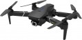 |
|---|---|---|
| Eachine E520S | Eachine E520 | |
| Outdated Product | Outdated Product | |
| TOP sellers | ||
Folded size — 150x110x75 mm. Can be equipped with additional batteries. The difference between the E520S model and the E520 in the presence of GPS and automatic flight modes | Folded size — 150x110x75 mm. Can be equipped with additional batteries. The difference between the E520 model and the E520S in the absence of GPS and automatic flight modes | |
Flight specs | ||
| Maximum flight time | 17 min | 17 min |
Camera | ||
| Camera type | built-in | built-in |
| HD filming (720p) | 1280x720 px | 1280x720 px |
| Full HD filming (1080p) | 1920x1080 px | 1920x1080 px |
| Quad HD filming | 2560x1440 px 30 fps | 2560x1440 px 30 fps |
| Viewing angles | 120° | 120° |
| Live video streaming | ||
| Memory card slot | ||
Flight modes and sensors | ||
| Flight modes | return "home" Follow me (tracking) Orbit mode (flying in a circle) flyby GPS points | |
| Sensors | GPS module heights gyroscope | heights gyroscope |
Control and transmitter | ||
| Control | remote control and smartphone | remote control and smartphone |
| Range | 300 m | 300 m |
| Control frequency | 2.4 GHz | 2.4 GHz |
| Smartphone mount | ||
| Remote control power source | 4xAAA | 4xAAA |
Motor and chassis | ||
| Motor type | brushless | brushless |
| Number of screws | 4 pcs | 4 pcs |
| Foldable design | ||
Battery | ||
| Battery capacity | 1.2 Ah | 1.2 Ah |
| Voltage | 7.4 В | 7.4 В |
| Battery model | 2S | 2S |
| Batteries in the set | 1 pcs | 1 pcs |
| USB charging | ||
General | ||
| Protected case | ||
| Body backlight | ||
| Material | plastic | plastic |
| Dimensions | 230x190x75 mm | 230x190x75 mm |
| Dimensions (folded) | 150x110x75 mm | 150x110x75 mm |
| Weight | 280 g | 280 g |
| Color | ||
| Added to E-Catalog | april 2020 | april 2020 |
Compare Eachine E520S and E520
You may be interested in
Eachine E520S often compared

Glossary
Flight modes
— Return home function. With this function, the quadcopter can automatically return to the starting point. The specific details of this feature may vary. So, some models return "home" at the user's command, others are able to do it on their own — for example, when the signal from the remote control is lost or when the battery charge is critically low; in many devices, both options are provided at once. Also note that this function is found even in models that do not have a GPS module (see "Sensors") — the copter can navigate in space in another way (by inertial sensors, by a signal from the remote control, etc.).
— Follow me mode. A mode that allows the quadcopter to constantly follow the user at a short distance — like a "personal drone". The way to implement this mode and the equipment required for it can be different: some models track the direction to the transmitter and the signal strength from it, others constantly receive data from the GPS module of a smartphone or other gadget and follow these coordinates, etc. Anyway, such a mode can be useful not only for entertainment, but also for quite practical purposes — for example, for using a quadcopter as an “air chamber”, constantly located next to the operator and at the same time not occupying hands.
— Dronie (distance). Initially, the term “dronie” refers to a selfie (photo or video) taken from a...drone. This mode is mainly intended for such tasks. And its essence lies in the fact that the copter smoothly moves away from a certain object along a given trajectory, keeping this object in the centre of the frame. The classic version of flying in Dronie mode is moving away first horizontally, then horizontally and up; however, in some models, the copter’s trajectory can be further configured. Frame management can also be carried out in different ways — from simple pointing at a certain point and ending with the selection of an object on the screen with further "smart" tracking of this object. Anyway, for all its simplicity, such a shooting technique allows you to create quite interesting videos: for example, in this way you can first capture a group of people in close-up in one video, then the beauty of the landscape around them.
— Rocket (distance up). A flight mode in which the copter smoothly rises to a predetermined altitude along a strictly vertical trajectory. Similar to the Dronie described above, it is mainly used when shooting video: first, a certain scene is shot in close-up, and as it rises, the camera covers an increasingly wider area around this scene. Usually, in Rocket mode, you can pre-set the height at which the device will stop.
— "Orbit mode" (flying in a circle). A mode that allows you to launch the copter in a circular orbit around the specified point. It is also used mainly for shooting video: in such cases, the camera remains constantly pointed at a given object, but the angle and background, due to the movement of the drone, are constantly changing. In the "orbit" settings, usually, you can set its radius, height and direction of movement, as well as the angle of the camera.
— Helix (circle in a spiral). Another mode used as an artistic technique for filming videos. In this mode, the copter, keeping a given object in the centre of the frame, moves around it in a spiral, gradually moving away and increasing its height. This allows you to get the maximum variety of angles and angles of coverage.
Note that Dronie, Rocket, Helix, and Orbit modes originally appeared as part of the proprietary QuickShot toolkit in DJI's Mavic series drones. However, later similar functions were introduced by other manufacturers, so now these names are used as common nouns.
— Flight plan(Waypoints). The ability to set a specific flight route for the quadcopter, by control points. This feature is very similar to the GPS waypoint flyby (see above), but it works differently, without the use of GPS navigation. One of the most popular options is building a route in the smartphone application through which the copter is controlled; when the programme is launched, the smartphone issues a sequence of commands corresponding to the route to the device. In general, the Waypoints mode is not as accurate as a GPS waypoint flyby and offers fewer options. Therefore, this function is mainly for entertainment purposes; if the copter has a camera, it can be useful for taking a selfie or a simple video.
— Flight by GPS points. A mode that allows you to launch a quadcopter along a specific route — by setting individual route points to the car in advance (according to GPS coordinates) and the order in which they are passed. In addition, additional settings may be provided — for example, speed and altitude on individual sections of the route. This function is similar to the Waypoints mode (see below) in many ways, but it is found mainly in mid-range and high-end devices. At the same time, the use of GPS provides higher accuracy, which allows the drone to be used for professional purposes. For example, if you set a route for shooting from the air in this way, the operator will be able to fully concentrate on working with the camera, without being distracted by controlling the copter.
— Acrobatic mode. A special mode for performing aerobatics. Note that the specific meaning of this mode may be different, depending on the level and purpose of the copter. So, in the simplest entertainment models, automatic programs are usually provided that allow you to perform certain aerobatic manoeuvres literally “at the touch of a button”. And in advanced devices in flight mode, the stabilization system is turned off, and the drone is very sensitive to operator commands; this requires high precision in control, but gives maximum control over the flight.
Sensors
Additional sensors provided in the design of the quadcopter.
— Heights. A sensor that determines the flight altitude of the machine. Such sensors can use the barometric or ultrasonic principle of operation. In the first case, the height is measured by the difference in atmospheric pressure between the current point and the starting point (that is, the sensor determines the height relative to the initial level); in the second, the sensor acts similarly to sonar, sending a signal to the ground and measuring the time it takes to return. Barometric sensors are not very accurate, but they work well at high altitudes — tens and hundreds of metres; ultrasonic — on the contrary, they allow you to accurately manoeuvre at low level flight, but lose effectiveness as you climb. However, in some advanced models, both options may be provided at once. Data from the height sensor can either be used by the quadcopter “independently” (for example, when hovering or automatically returning), or transmitted to the operator to the remote control or smartphone.
— Optical. A sensor that allows the quadcopter to "see" the environment in certain directions. One of the simplest variants of such a sensor is a downward-facing camera that allows the device to “copy” the surface under which it flies. Due to this, the machine, for example, can navigate indoors, where the signal from GPS satellites does not reach. In...addition to such a chamber, "eyes" can also be provided from different sides of the machine. Note that optical sensors have certain limitations in their use — for example, they lose their effectiveness on dark, shiny or uniform (without noticeable details) surfaces, as well as at high speeds.
— GPS module. A sensor that receives signals from navigation satellites (GPS, in some models also GLONASS) and determines the current geographical coordinates of the machine. Specific ways of using position data can be different: returning home, flying by waypoints (see below), recording a flight route, etc.
— Gyroscope. A sensor that determines the direction, angle and speed of the machine's rotation along a specific axis. Modern technologies make it possible to create full-fledged three-axis gyroscopes of very compact dimensions, and it is with such modules that quadcopters are usually equipped. On the basis of gyroscopes, automatic stabilization systems usually work, returning the car to a horizontal position after a gust of wind, collision with an obstacle, etc. At the same time, such equipment affects the cost of the device, and in some cases (for example, during piloting), automatic stabilization is more of a hindrance than a useful feature. Therefore, some low-cost, as well as advanced aerobatic quadcopters, are not equipped with gyroscopes.