Comparison Navitel T700 3G vs Navitel E500
Add to comparison | 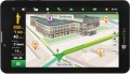 | 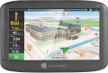 |
|---|---|---|
| Navitel T700 3G | Navitel E500 | |
| Outdated Product | from $84.00 | |
| User reviews | ||
| TOP sellers | ||
| Application area | cars | cars |
Software | ||
| Pre-installed soft | Navitel Navigator | Navitel Navigator |
Receiver | ||
| Bands number | 66 | 66 |
Display specs | ||
| Display | 7 " 1024х600 px touch | 5 " 800х480 px touch |
Additional equipment | ||
| More features | Cellular module digital camera video player image display MP3 player | video player image display MP3 player |
| CPU speed | 1300 MHz | 800 MHz |
| RAM | 128 MB | |
Connections | ||
| Interfaces | Wi-Fi USB memory card slot headphone output Bluetooth | USB headphone output |
General | ||
| Power supply | rechargeable battery | rechargeable battery |
| Battery capacity | 950 mAh | |
| Added to E-Catalog | september 2017 | january 2017 |
Compare Navitel T700 3G and E500
You may be interested in
My comparisons
Navitel T700 3G often compared


Navitel E500 often compared


Glossary
Display
Parameters of the display installed in the navigator.
— Display diagonal. Size screen size in inches. The larger the screen, the more information can be displayed on it and the more detailed this information will be presented. On the other hand, the size of the display significantly affects the dimensions of the device, and large screens are more expensive.
— Display resolution. Display size in dots (pixels) horizontally and vertically. The higher the resolution (with the same diagonal), the more detailed and clear the image the screen can produce. In addition, on high-resolution displays, small details are better visible, which increases the comfort of viewing information. Too high a resolution is usually not required for GPS navigator displays: for example, 800x480 pixels, limited by the standards of smartphones or tablets, with a diagonal screen size of about 6” are considered quite sufficient even for an advanced device.
— Matrix type. This parameter is indicated mainly for tech cases when the screen uses a high-quality IPS type matrix. This technology provides high quality color rendering, good brightness and wide viewing angles; moreover, IPS screens are relatively inexpensive to produce.
- Touch. Screen support for touch control. You can give commands to the device by touching the icons on the display itself - similar to how this is done in smartphones and tablets. Touch control opens up...many more possibilities than classic controls and provides flexibility in working with the navigator. In particular, by touching the screen you can set points on the route, zoom in or out on the map, etc.
- Color. This parameter determines whether the screen is color or monochrome (black and white). Black and white displays are simple, inexpensive, consume little power, and are quite suitable for displaying basic navigation information. At the same time, color screens are more functional: maps often use different colors to highlight individual objects, which would not be possible on monochrome displays. As a result, black and white screens are quite rare among modern navigators - mainly among the most compact and inexpensive models.
— Backlight. The screen has its own backlight system. This function makes the device independent of external lighting: the illuminated image will be normally visible both at dusk and even in complete darkness. It is also worth noting that many LCD screens have a backlight by default; it is activated when the screen itself is turned on and works regardless of external lighting - without it, the image on the matrix would simply be impossible to see. In particular, this operating principle is used in IPS-type matrices, which have gained popularity in modern portable electronics (including navigators).
More features
— GSM/GPRS module. Built-in wireless cellular module, similar to those found in GSM mobile phones. However, unlike phones, in GPS navigators this communication is intended solely for Internet access. Most often it is used to obtain information about traffic jams, although some advanced models may provide the ability to fully view Internet pages through the built-in browser. To use the GSM/GPRS module, as in the case of a mobile phone, you need to purchase a SIM card from a mobile operator.
— Digital camera. The navigator has its own digital camera; in some models there may even be two such cameras, on both sides of the body. The specific functionality of a digital camera(s) may vary depending on the capabilities of the device itself. Thus, most models with a DVR function use a built-in camera (for more details, see “Built-in DVR”). If you have a telephone module (see the corresponding paragraph), the camera can be useful for video communication. Many navigators with this function can also be used for classic photo/video shooting; The image quality, however, is usually relatively low.
— Video player. Ability to use the navigator to play video files. As a rule, we are talking about playing video on your own display - accordingly, the display itself is made in color and quite large for this purpose. This function is found mainly among car navigators (see “Sc...ope”), it is especially appreciated by drivers who have to spend a lot of time waiting - in particular, taxi drivers and truck drivers.
- Voice control. The ability to control the navigator using voice commands. This feature is especially convenient for automobile and motorcycle devices: it allows you to control the device without taking your hands off the controls and without taking your eyes off the road. However, before purchasing such a model, it would not hurt to clarify which languages it supports for voice control.
— Playback images. Ability to use the navigator screen to view graphic files; By default, JPG support is implied; other graphic formats are somewhat less common. A navigator with this function can be used as a digital photo frame - connect an external storage device and view pictures directly, without the participation of a computer. This function can be useful, for example, for viewing photos taken during a trip (when you don’t want to wait to get back to the computer), or for more specific purposes - for example, clarifying navigation data from a scan of a paper map.
— MP3 player. The ability to play audio files with the navigator (most often in MP3 format, hence the name). Playback can occur through headphones or an external audio system (if it is possible to connect them) or through the navigator’s own speaker. Such files can be stored in the device’s own flash memory or on removable memory cards.
— FM transmitter. Low-power FM transmitter with an effective range of several meters. It is one of the simplest ways to connect a navigator to a car's speaker system - just tune the FM receiver of the car radio to the frequency of the transmitter. In this way, you can use the car speakers, for example, to play voice prompts, music (see MP3 player) or the soundtrack of a movie being played (see Video player).
— Barometer. An auxiliary function that allows you to measure atmospheric pressure. It is often used as an additional tool in navigators with the function of measuring altitude using signals from satellites - this ensures increased accuracy of the received data. In addition, data from the barometer can be useful in forecasting the weather for the near future: for example, a sharp drop in pressure usually means worsening weather - even a storm or even a hurricane.
CPU speed
Clock speed of the processor (CPU) installed in the navigator.
This parameter is often used to evaluate the overall level of the device and the power of its filling: it is believed that a higher frequency, in turn, provides greater computing power and better performance. However, the technical features of the processors are such that a high clock frequency does not always mean a more advanced chip. In addition, the processing power of the entire device depends not only on the CPU, but also on other components — from RAM to the operating system and installed software. So this information plays only a supporting role.
This parameter is often used to evaluate the overall level of the device and the power of its filling: it is believed that a higher frequency, in turn, provides greater computing power and better performance. However, the technical features of the processors are such that a high clock frequency does not always mean a more advanced chip. In addition, the processing power of the entire device depends not only on the CPU, but also on other components — from RAM to the operating system and installed software. So this information plays only a supporting role.
RAM
The amount of random access memory (RAM) installed in the navigator.
The amount of RAM is one of the key parameters of any computer system, directly affecting its performance and computing power. The more RAM installed on board, the better the device will cope with resource-intensive tasks and the more applications you can run on it without noticeable damage to the speed of operation.
Specifically in navigators, performance can be important, for example, when driving at high speed - the “braking” device may be late with a hint, which causes various unpleasant situations to arise. At the same time, paying attention to the amount of RAM only makes sense if an operating system like Android is installed on board.
Interfaces
— Wi-Fi. A technology originally designed to connect to the Internet through wireless access points; for the same purpose, Wi-Fi is most often used in navigators. Note that not only a stationary router can play the role of an access point, but also a smartphone — many of these gadgets have the appropriate mode. But the specific possibilities of such a connection may be different. One of the most popular features is downloading up-to-date traffic data and other traffic information (see "Features"). In addition, navigators may provide updating maps and firmware via the Internet. And for models with full-fledged OS (see "Operating System"), the ways of using Wi-Fi are very diverse: web surfing, access to social networks and instant messengers, "social" games that involve communication with other players, etc. In fact , in navigators with OS, Wi-Fi capabilities are limited only by the set of installed applications.
— USB. The device has a USB connector. Most often, modern navigators are equipped with compact ports like miniUSB or microUSB, and the main purpose of such ports is to charge the battery and connect to a computer — for example, to update maps. The most advanced models may also provide the connection of external peripherals (for example, a flash drive with map updates or a 3G modem for Internet access), but such features are quite rare, mainly among navigators with a full-fledged OS (see "Opera...ting system").
— Slot for memory cards. A device for reading removable memory cards — most often in the SD or microSD form factor; specific types of supported cards should be specified separately. Such a device (card reader) performs two main functions. Firstly, it allows you to expand the built-in memory of the navigator by supplementing it with external media; at the same time, the capacity of the card can be chosen at your discretion (taking into account the maximum volume — see below). Secondly, the card reader facilitates the exchange of data with other devices — smartphones, tablets, laptops, etc.; this can be useful, for example, for loading maps and other navigation data, for copying recorded tracks, etc. The specific functionality of the card reader should be specified separately.
— Headphone output. The presence in the navigator of a special connector for connecting headphones. Usually the role of such an output is played by a standard 3.5 mm port. Headphones can be used for any tasks related to sound accompaniment — voice prompts, talking on the phone or via the Internet (via Skype, Viber, etc.), listening to music and watching videos, etc. (depending on which functions are provided in the navigator itself). At the same time, the “ears” are especially convenient in two situations: in a noisy environment, when the speaker of the navigator may not be heard over background sounds, and also when it is desirable to avoid unnecessary sounds (for example, if passengers are sleeping in the car).
— Bluetooth. A wireless communication technology designed to connect different devices directly to each other. The method of using such a connection can be different, one of the most popular options in navigators is connecting a wireless headset. Through such a headset, you can hear the voice prompts of the navigator and give commands to it, talk on the phone, listen to music, etc. (specific possibilities, of course, depend on the functionality of the navigator itself). However headsets are more expensive than wired headphones and have a limited operating time (the battery needs to be charged periodically); but they are much more comfortable.
— ANT+. This standard is mainly used to transmit information of a sports and medical nature — heart rate, distance traveled, speed, etc. It is characterized by low power consumption, but has a low bandwidth — up to 60 kbps. For ANT + to work, it must be supported not only by the gadget, but also by the smartphone or other device to which it is connected. At the same time, we note that, in addition to a direct connection to an external device, this standard allows you to build networks from ANT +-compatible devices — including integrate them into smart home systems.
— AV input. Input for connecting a composite (audio + video) analogue signal. With such an input, you can connect an external signal source to the navigator, such as a portable DVD player, a reversing camera (in car navigators), an echo sounder (in marine ones), etc.
Battery capacity
This parameter directly determines the amount of energy that the battery can store; and the greater the energy reserve, the longer the device can work on one battery charge. However, this is in theory; in practice the situation is somewhat more complicated. Firstly, the actual autonomy of the navigator will also depend on the power consumption of the device - and it can vary greatly between different models. Secondly, milliamp-hours, in which capacity is indicated, is not a completely reliable unit: the physical features of such a designation are such that two batteries with the same capacity in mAh, but different nominal voltages, will also have different actual amounts of stored energy.
In light of all this, it is hardly worth assessing the autonomy of the navigator by the capacity of the included battery - it is better to look at the operating time directly stated by the manufacturer.
In light of all this, it is hardly worth assessing the autonomy of the navigator by the capacity of the included battery - it is better to look at the operating time directly stated by the manufacturer.