Pre-installed soft
The navigation programme, originally installed in the navigator and sold with it, in other words, a set of maps available to the user “out of the box”.
Most modern navigators are equipped with such programs (although the name of pre-installed maps is not indicated for all models). Note that the functionality of complete programs in different models may vary. Most often, these are the simplest maps of the world or the region in which this device is sold. However, there are exceptions: there are models with detailed maps, programs with advanced functionality, etc. Such exceptions are especially common among high-end specialized devices, in particular marine and aviation (see "Scope"). And for some navigators, there may be several options for pre-installed programs and even the ability to select such programs at the request of the user. All these details should be specified in each case according to the manufacturer or seller.
It is also worth considering that the characteristics often indicate only the general name of the cards. At the same time, the same card can be available in several versions that differ in functionality and, sometimes, terms of use (paid / free). However, the main features are basic capabilities, interface device, etc. — usually, are common to all versions. Therefore, by the name of the complete programme, usually, one can quite accurately determine the general capabilities and features of the card's functionality.
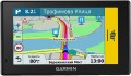
Map coverage
The region of the world for which map data is available on your navigation device. Map coverage determines which geographic areas and countries can be displayed and used for navigation on a specific device. Note that coverage may vary in detail and content: some preset maps may contain detailed information about roads, landmarks, shops, gas stations and the like on a global scale, while others are often limited to the basic road network for a particular country or region .
To make it easier to find a suitable solution for map coverage, registrars can be divided into several subcategories based on territoriality:
Europe,
Africa,
the whole world.
Navigation functions (assistants)
Special navigation functions provided in the device.
—
Speed limit. A function that allows you to use the navigator to obtain information about the speed limit on a particular road. Most often, the speed limit is used in the operational prompt mode: the device warns the driver in advance about approaching a section of the road where the speed limit differs from the current one, and also issues a warning if the driver accelerates above the permissible limit. This can prevent not only an unpleasant conversation with the traffic police, but also a serious accident.
—
Traffic jams in real time. A function that allows the driver to see real-time traffic data on the device screen. As a rule, models with a traffic monitoring function provide detailed information about the volume of traffic in general. Moreover, this information is monitored and updated constantly, in real time, and is immediately taken into account by the navigator - to the point that if difficulties arise on a pre-planned route, the device can automatically reroute it to avoid congestion. At the same time, it is worth considering that real-time traffic data is usually transmitted through the TMC network (see “TMC receiver”), and it is not available everywhere.
—
GPS informant. A function to provide the driver with various useful information related to the current location. In acc
...ordance with the name, the coordinates are determined using GPS. One of the most common ways to use an informant is to warn about approaching traffic cameras, stationary traffic police posts and speed control systems. In addition, other functions may be provided - for example, informing about entering a section of the road with a high accident rate or a separate large hole on the roadway. To operate the GPS informer, a database of relevant objects is entered into the device’s memory. When purchasing a navigator, it doesn’t hurt to clarify what exactly this database contains, how recent it is, and whether it can be updated.
— Lane selection. A function that provides the driver with hints regarding lane selection. Such tips make driving more convenient and safe: the navigator warns the driver in advance about the need to change lanes for a turn/turn (or vice versa, in order to drive straight past the turn). This allows you to avoid “misses” on the road and emergency lane changes, which often create emergency situations. This function is especially relevant for complex interchanges on multi-lane highways.
— Parking in real time. As its name suggests, this feature allows you to determine if there are nearby parking options for your vehicle. In addition, navigators that support the real-time parking function are also capable of displaying various auxiliary information, for example, type of parking, parking cost, payment methods, etc.
— The way back. The function of using a record of the distance traveled as a route to return from the finish point to the start point. Thanks to it, the customer can go back the same way he got to the current point. This opportunity is especially important in conditions of difficult terrain and the absence of roads - for example, during hiking trips or off-road jeep trips: returning along an already explored path is often easier and safer than looking for a new route. Actually, the opposite way is found mainly among universal pocket navigators (see “Scope of Application”), although there are exceptions - for example, the same car models.
- “Where am I?”. A function that helps the customer determine their current location. At the same time, we are talking not only about a point on the map and geographic coordinates - in addition to this data, the navigator, when you turn on the “Where am I?” function. displays various additional information: the address of the nearest building, information about the nearest intersection, nearby important objects (gas stations, hospitals, police stations, etc.).
— Prices at gas stations in real time. A function that provides information about current fuel prices at various gas stations along your travel route. It can be useful for drivers, as it allows them to find the most profitable or nearest gas stations to refuel and save money.
— Weather in real time. A feature that allows the navigator to receive real-time weather data. This can be either information about current weather conditions in a particular place on the map, or a forecast for a certain period. In addition to basic weather information (temperature, fit, wind, humidity, fog, etc.), this service can support advanced data such as storm warnings, flood or landslide reports. The necessary data can arrive in different ways - most often through a satellite or a special radio channel. These details should be clarified separately.
- Supervision of children. A function that allows the driver to use the navigator screen to observe the rear seat of the car without turning around and without being distracted from the road. Most often it is used to monitor a child who is in the back seat. Of course, to use the child monitoring function you will need not only a navigator, but also a camera compatible with it.Video resolution
Resolution of the video recorded by the
built-in video recorder of the navigator
The higher the video resolution, other things being equal, the more detailed the video is, the better you can see the small details of what is happening on it. This is especially important when analyzing traffic accidents or ambiguous situations, as well as identifying people, fixing car numbers, etc. On the other hand, higher resolution requires more powerful hardware and more capacious drives for storing footage — all this has a corresponding effect on the price of the device.
Frame rate
The frame rate at which the built-in DVR can capture video.
The higher the frame rate, ceteris paribus, the smoother the image, the less fast moving objects are blurred, and the more accurately you can make out the details in dynamic scenes (including freeze frames). On the other hand, a high frame rate increases the power requirements of the electronic hardware. Therefore, in navigators, this indicator usually does not exceed 30 fps — this provides a fairly good shooting quality with relatively low hardware requirements.
Sound recording
Possibility of sound recording by the built-in video recorder of the navigator.
In this case, we are talking about sound recording in the cabin. Such a "soundtrack" can give a lot of additional information about the situation recorded by the device. For example, in the event of an accident, it can be established whether the driver was talking on the phone at the time of the accident, when he noticed the danger on the road, how he reacted to it, etc.
G-sensor
A sensor that monitors shocks and vibrations acting on the device. The main function of this sensor is to ensure the safety of video footage captured by the DVR in the event of an accident: in the event of a strong impact, typical of a collision or fall, the DVR with a G-sensor automatically saves the previously recorded video to a non-volatile memory protected from overwriting. Thus, materials about an emergency are not only guaranteed to be saved, but with a high probability remain intact even if the navigator itself is damaged.
Interfaces
—
Wi-Fi. A technology originally designed to connect to the Internet through wireless access points; for the same purpose, Wi-Fi is most often used in navigators. Note that not only a stationary router can play the role of an access point, but also a smartphone — many of these gadgets have the appropriate mode. But the specific possibilities of such a connection may be different. One of the most popular features is downloading up-to-date traffic data and other traffic information (see "Features"). In addition, navigators may provide updating maps and firmware via the Internet. And for models with full-fledged OS (see "Operating System"), the ways of using Wi-Fi are very diverse: web surfing, access to social networks and instant messengers, "social" games that involve communication with other players, etc. In fact , in navigators with OS, Wi-Fi capabilities are limited only by the set of installed applications.
—
USB. The device has a USB connector. Most often, modern navigators are equipped with compact ports like miniUSB or microUSB, and the main purpose of such ports is to charge the battery and connect to a computer — for example, to update maps. The most advanced models may also provide the connection of external peripherals (for example, a flash drive with map updates or a 3G modem for Internet access), but such features are quite rare, mainly among navigators with a full-fledged OS (see "Opera
...ting system").
— Slot for memory cards. A device for reading removable memory cards — most often in the SD or microSD form factor; specific types of supported cards should be specified separately. Such a device (card reader) performs two main functions. Firstly, it allows you to expand the built-in memory of the navigator by supplementing it with external media; at the same time, the capacity of the card can be chosen at your discretion (taking into account the maximum volume — see below). Secondly, the card reader facilitates the exchange of data with other devices — smartphones, tablets, laptops, etc.; this can be useful, for example, for loading maps and other navigation data, for copying recorded tracks, etc. The specific functionality of the card reader should be specified separately.
— Headphone output. The presence in the navigator of a special connector for connecting headphones. Usually the role of such an output is played by a standard 3.5 mm port. Headphones can be used for any tasks related to sound accompaniment — voice prompts, talking on the phone or via the Internet (via Skype, Viber, etc.), listening to music and watching videos, etc. (depending on which functions are provided in the navigator itself). At the same time, the “ears” are especially convenient in two situations: in a noisy environment, when the speaker of the navigator may not be heard over background sounds, and also when it is desirable to avoid unnecessary sounds (for example, if passengers are sleeping in the car).
— Bluetooth. A wireless communication technology designed to connect different devices directly to each other. The method of using such a connection can be different, one of the most popular options in navigators is connecting a wireless headset. Through such a headset, you can hear the voice prompts of the navigator and give commands to it, talk on the phone, listen to music, etc. (specific possibilities, of course, depend on the functionality of the navigator itself). However headsets are more expensive than wired headphones and have a limited operating time (the battery needs to be charged periodically); but they are much more comfortable.
— ANT+. This standard is mainly used to transmit information of a sports and medical nature — heart rate, distance traveled, speed, etc. It is characterized by low power consumption, but has a low bandwidth — up to 60 kbps. For ANT + to work, it must be supported not only by the gadget, but also by the smartphone or other device to which it is connected. At the same time, we note that, in addition to a direct connection to an external device, this standard allows you to build networks from ANT +-compatible devices — including integrate them into smart home systems.
— AV input. Input for connecting a composite (audio + video) analogue signal. With such an input, you can connect an external signal source to the navigator, such as a portable DVD player, a reversing camera (in car navigators), an echo sounder (in marine ones), etc.Battery life
The operating time of the navigator on one battery charge or a set of batteries depends on the power source (see above).
This parameter is more visual and closer to reality than technical information about the type of batteries, battery capacity, etc. However note that the operating time is usually indicated for a conditional perfect situation: a good signal level without the need to reconnect, low screen brightness ( or completely turned off the backlight), minimal use of wireless modules (Wi-Fi, Bluetooth), etc. Practical conditions inevitably differ from perfect — accordingly, the operating time may differ noticeably from the claimed one (usually in the direction of reduction, but sometimes vice versa) . Nevertheless, the operating time stated in the characteristics is quite reliable information, and it is quite possible to evaluate the capabilities of the selected device, as well as compare it with other models.