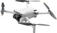
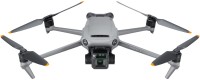
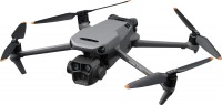
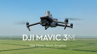
DJI Mavic 3M
 | Compare prices 2 → When you make a purchase through links on our site, we may receive a affiliate commission.
|
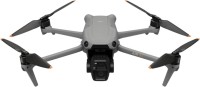
A specialized aerial platform released in 2023, designed for precise agriculture, environmental monitoring, and surveying. A key feature of this device is the hybrid imaging system: the main wide-angle RGB module with a 4/3-inch sensor and 20 MP resolution comes with a mechanical shutter to prevent image blurring during motion, which is critically important for creating orthophotos.
It is complemented by an array of four multispectral cameras, each 5 MP, capturing data in green, red, "red edge", and near-infrared bands to calculate vegetation indices (NDVI) and assess crop health. To enhance data reliability, the high-tech DJI Mavic 3M quadcopter (drone) is equipped with an integrated sunlight sensor that compensates for brightness fluctuations when constructing 2D models.
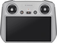
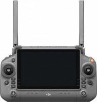
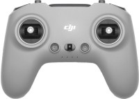
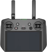
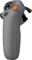
The navigation suite includes an RTK module for centimeter-level precision positioning, allowing missions to be performed without ground control points. Efficiency reaches up to 200 hectares per single flight lasting up to 43 minutes. Flight safety is ensured by an omnidirectional obstacle detection system and AirSense technology, alerting to the presence of manned aircraft. Control is managed via the DJI RC Pro Enterprise controller with a high-brightness screen, supporting video transmission up to 15 km.
|
| ||||||||||||||||||||||||||||||||||||||||||||||||||||||||||||||||||||||||||||||||||||||||||||||||||||||||||||||||||||||||||||||||||||||
Always clarify the specifications and configuration of the product with the online store manager before purchasing.
Catalog DJI 2026 - new arrivals, bestsellers, and the most relevant models DJI.


- Multispectral camera for scanning and analyzing crop growth (up to 200 hectares per flight).
- The maximum altitude above sea level for take-off without load is 6 km.
- Maximum flight range – 32 km, take-off weight – 1050 g.
- DJI AirSense support – warning the quadcopter pilot about the presence of civil aircraft in the vicinity.
- DJI Pilot 2 is an advanced flight interface for improved piloting efficiency and flight safety.
- DJI FlightHub 2 is a cloud-based operations management software for drone fleets (route planning and flight management).
- DJI Terra is a full-featured mapping software for all stages of work, from mission planning to processing 2D and 3D models.
- Built-in light sensor for brightness compensation when building 2D aerial models.
- sensor: 1/2.8" CMOS, 5 MP effective pixels
- lens: f/2.0, viewing angle 73.91°, focal length 25 mm, fixed focus
- maximum photo resolution 2592x1944, video 1920x1080 at 30 fps
- spectral analysis: wavelength 560 ± 16 nm (green), wavelength 650 ± 16 nm (red), wavelength 730 ± 16 nm (extreme red), wavelength 860 ± 26 nm (near infrared)