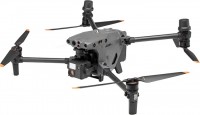
DJI Mavic 3T (CP.EN.00000415.01)
 |
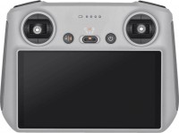
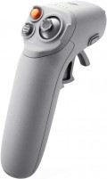
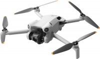
2022 foldable industrial quadcopter equipped with high-quality optical, powerful thermal imaging camera and professional DJI RC Pro Enterprise remote control. Positioned as a product in the upper price category, aimed at professional use. This drone is equipped to allow operators to measure the temperature of remote objects/structures and securely store all data for efficient reporting and analysis in the field of industrial equipment inspections, utility rigging or emergency response.
Supports an innovative feature that integrates data from visual and thermal cameras in real time. Displays the average temperature of an object, helping the operator control dangerous objects at a safe distance. Allows you to analyze the received data in real time. The performance of the wide-angle camera of the DJI Mavic 3T quadcopter is somewhat inferior to the characteristics of similar cameras on other quadcopters of the Mavic 3 family, but this is still quite enough to provide good quality visual data that can help you quickly make the right decision right during shooting. A built-in beacon enhances flight safety by allowing other pilots to detect the drone (can be disabled). It is also possible to hang a high-power speaker (purchased separately) that is capable of transmitting voice or playing back recordings.
|
| ||||||||||||||||||||||||||||||||||||||||||||||||||||||||||||||||||||||||||||||||||||||||||||||||||||||||||||||||||||||||||||||||||||||
Always clarify the specifications and configuration of the product with the online store manager before purchasing.
Catalog DJI 2025 - new arrivals, bestsellers, and the most relevant models DJI.
- Telephoto lens characteristics: 1/2", f/4.4 CMOS matrix, 15° viewing angle, 12 MP, 4K 30 fps, 56x hybrid zoom.
- The maximum altitude above sea level for take-off without load is 6 km.
- Maximum flight range – 32 km, take-off weight – 1050 g.
- DJI AirSense support – warning the quadcopter pilot about the presence of civil aircraft in the vicinity.
- DJI Pilot 2 is an advanced flight interface for improved piloting efficiency and flight safety.
- DJI FlightHub 2 is a cloud-based operations management software for drone fleets (route planning and flight management).
- DJI Terra is a full-featured mapping software for all stages of work, from mission planning to processing 2D and 3D models.
- DJI Thermal Analysis Tool 3.0 – Helps analyze images captured by the Mavic 3T using DTAT 3.0 to detect temperature variations.
- Type - uncooled bolometer based on vanadium oxide
- Aperture - f / 1.0
- Viewing angle - 61°
- Focus - 5 m to infinity
- Sensitivity – ≤50mk@F1.1
- Video resolution - 640x512 at 30 fps
- IR wavelength - 8-14 nm
- Measuring temperature range: -20°..150° C (high gain mode), 0°..500° C (low gain mode)
- Measurement accuracy - ±2° C or ±2% (whichever is greater)


