
Fish Finders
prices on 623 modelsShow
When you make a purchase through links on our site, we may receive a affiliate commission.
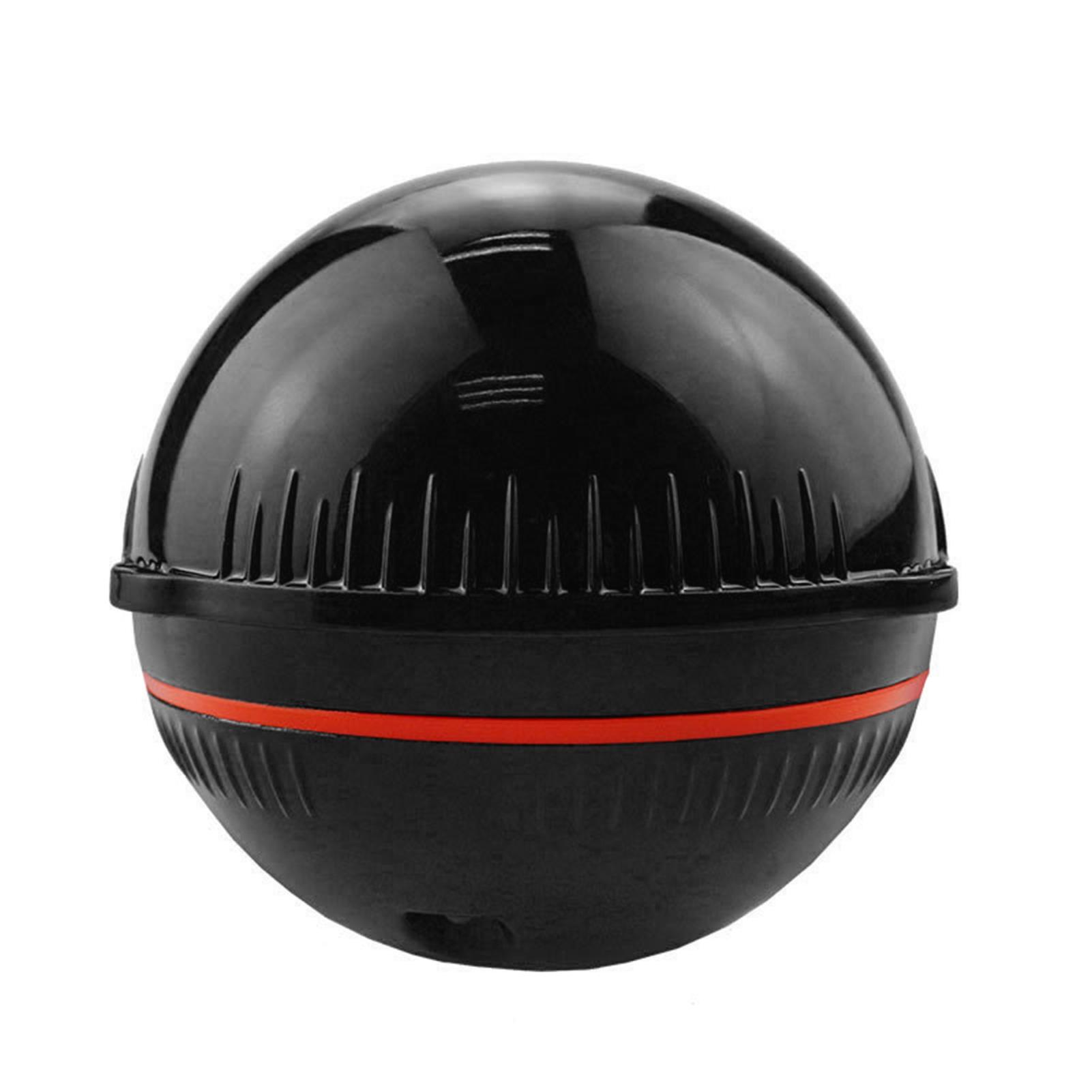 | This fish finder can provide smart detection and stable support in different weather situation.Good partner for day and night fishing. Features: BT2.0 function supports the connection with smart phone APP.Replacement for iOS and for Android devices.Receiving Distance: 20meters. High resolution imaging display allow you kow the real-time datas,like fish location,water depth,temperature,ba |  |
 | The HUMMINBIRD SM3000 3D/DI/SI Sonar Module in Grey/Black is an advanced electronic device designed for fishing enthusiasts. This module combines GPS and fishfinding capabilities to provide an all-in-one solution for locating fish and navigating the waters.Featuring a sleek grey and black design, the HUMMINBIRD SM3000 is equipped with state-of-the-art technology that allows users to have a comprehensive view of the underwater world. The 3D sonar technology provides a three-dimensional, detailed representation of the underwater terrain, enabling anglers to identify structures, vegetation, and potential fish habitats. This allows for more accurate and efficient fishing.In addition, the DI |  |
 | SHOM Unfolded Marine Chart: Mouth of Bonifacio – The Definitive Navigational ReferenceNavigate the legendary and demanding waters of the Mouth of Bonifacio with the unparalleled accuracy and authority of an official SHOM (Service Hydrographique et Océanographique de la Marine) marine chart. Specifically designed for sailors, yacht captains, and professional mariners who prioritize safety and precision, this unfolded paper chart provides a comprehensive, large-format view of one of the Mediterranean´s most stunning and challenging straits. While electronic cartography is essential, this official paper chart serves as the indispensable primary or backup tool for robust passage planning and real… | |
 | SHOM 7252L - Official Marine Chart for the Glenan IslandsEmbark on your next maritime adventure to the stunning Glenan archipelago with the utmost confidence and precision. The SHOM 7252L marine chart is the definitive navigational tool for exploring this jewel of the Brittany coast, often called the Breton Caribbean. While its crystal-clear waters and white sandy beaches are inviting, the intricate network of islands, islets, and submerged rocks demands the highest standard of cartographic accuracy for safe passage. This chart provides exactly that, ensuring your journey is both breathtaking and secure.Produced directly by the French Hydrographic and Oceanographic Office (SHOM), this is not … | |
 | SHOM 7252 L - Official Marine Chart for the Glenan IslandsNavigate the stunning and intricate waters of the Glenan Islands with the unparalleled accuracy and authority of the official SHOM marine chart 7252 L. Produced by the French Hydrographic and Oceanographic Office (SHOM), this chart is the definitive navigational tool for all mariners, from professional sailors to recreational boaters, seeking to safely explore this breathtaking Breton archipelago. The Glenan Islands are renowned for their crystal-clear lagoons and white sandy beaches, but also for their challenging navigational passages, submerged rocks, and strong currents. This chart provides the critical information needed to turn … | |
You may be interested in
 | Navigate with Unrivaled Precision: Official SHOM Marine Charts for France & Neighboring CoastsEmbark on your voyages with the utmost confidence and safety using the official electronic marine charts from SHOM (Service Hydrographique et Océanographique de la Marine). As the definitive cartographic authority for French waters, SHOM provides the most accurate, reliable, and up-to-date data essential for both professional mariners and discerning recreational sailors. This electronic cartography package is your indispensable tool for navigating the complex and beautiful coastlines of France and its adjacent maritime regions.Crafted from data collected and rigorously verified by the French government´s of… | |
 | Lucky Rambo Handheld Wireless Fish Finder with Wrist Strap. Regardless of experience, the popular tools of anglers include compact fish radars, which can be used to easily map the water areas in front of the fishing spot, the water depth itself, the bed conditions, and the location of the fish are no longer a secret.The Rambo among Lucky radars is a compact hand-held, wearable version that includes a wireless sonar in addition to basic accessories.The operation of sonar is based on the propagation of sound waves. The fish radar uses sonar to determine the contour, structure and depth of the bed. The sonar emits a sound wave and determines the distance to the object from the reflection time. … | |
 | HONDEX PS-7 Portable Submersible Probe 200 kHz: Instant Depth Readings in the Palm of Your HandDiscover the ultimate in portability and convenience with the HONDEX PS-7, a revolutionary handheld depth sounder and fish finder. Engineered for versatility and simplicity, the PS-7 provides immediate and accurate depth information wherever your adventure takes you. Ideal for divers, kayakers, small boat anglers, ice fishermen, and even for surveying from the shore, this compact device eliminates the need for complex installations and bulky equipment. Simply submerge the sensor end in the water and instantly read the depth on the clear, built-in LCD display.The HONDEX PS-7 is a testament to | |
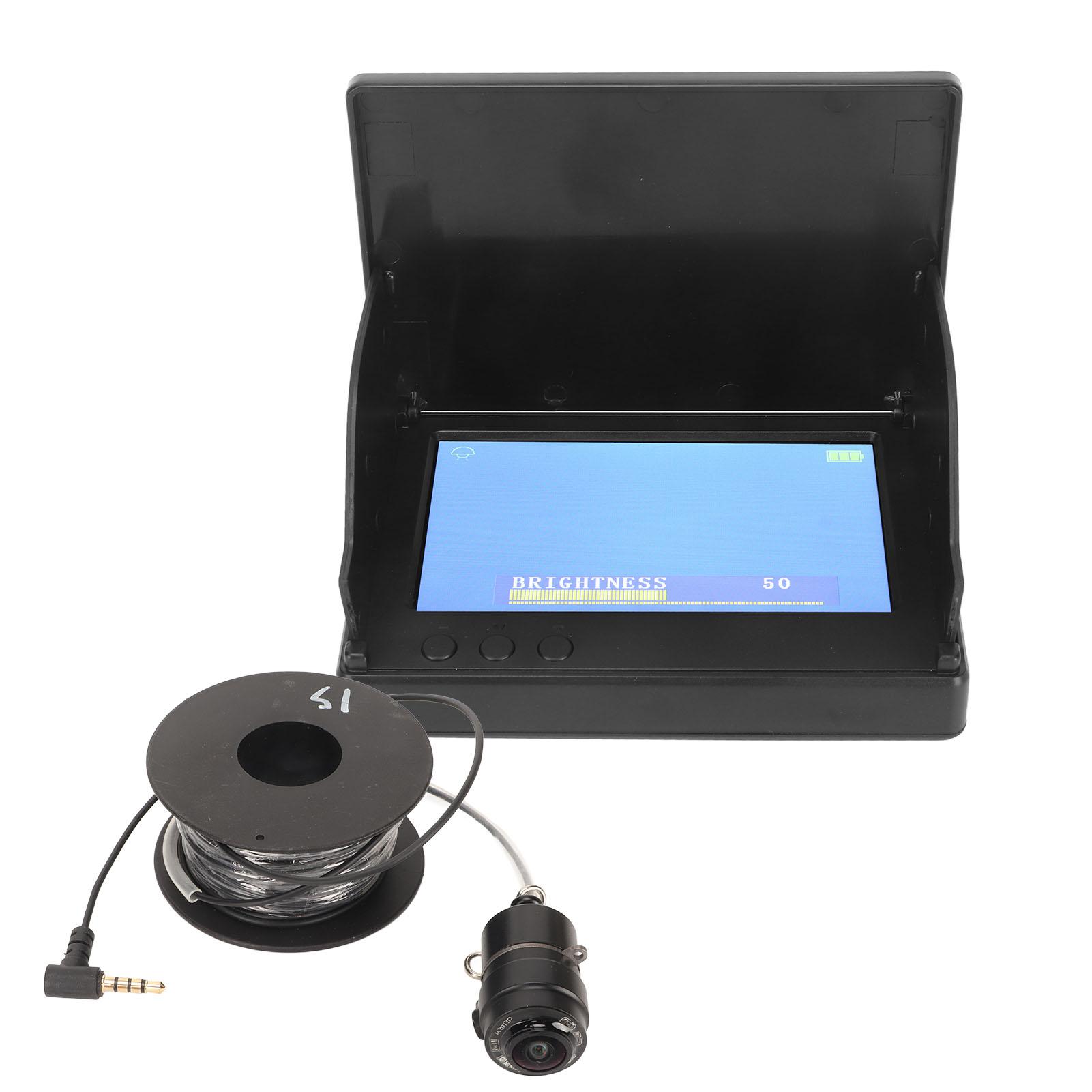 | Feature: 1. 4.3in Video Underwater Fish Finder: Underwater fish finder uses IP67 depth waterproof camera and 4.3in LCD screen to form a vision system that supports water depth and water temperature detection. 2. Easy To Use: Video fish finder built in 5000mAh rechargeable battery, the use time can last 4 to 6 hours. It can be powered by a 5V1A mobile power supply, equipped with a sun shade more convenient for outdoor use. 3. Night Vision: Portable underwater fishing camera with night vision, maximum detection depth of 30m, you can clearly see the fish bite day and night, it is ideal for sea fishing, ice fishing, lake fishing, boat fishing. 4. Long Lasting Use: Fish finder camera s screen is … |  |
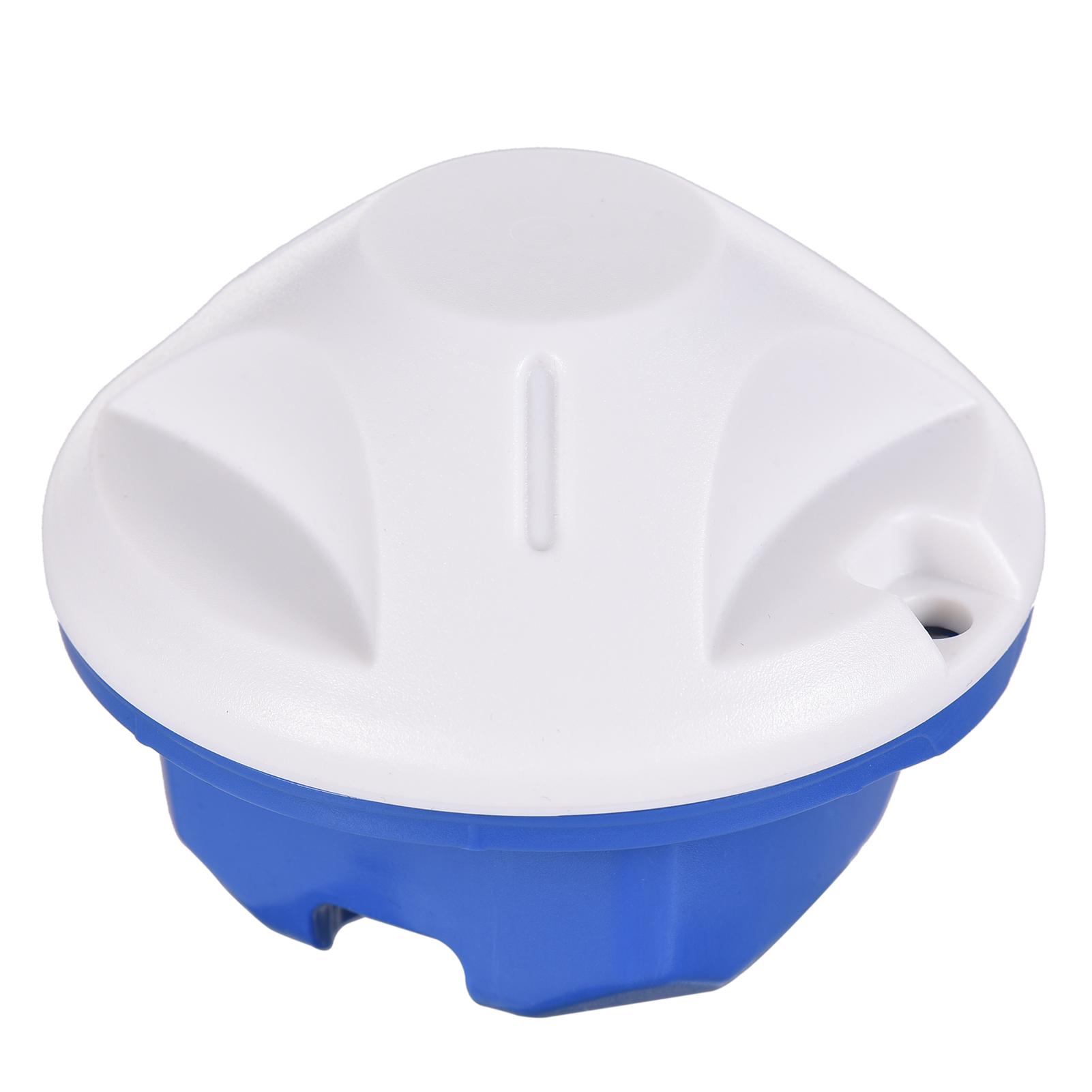 | Features: Detection range from 0.6m to 40m, with an accuracy of 0.1m. Displays water bottom contour, water temperature, big/small fish icon, fish depth indicator, battery indicator, fish condition and depth alarm sound. 100-level sensitivity setting, automatic and manual selection of depth range. Auto zoom and quick zoom; user selectable unit between meter and feet. 125KHz sonar frequency, with 90 degrees of wide detection angle. BT connection with your smartphone or tablet, wireless transmission range up to 60 meters. 3-5 hours of long working life on the rechargeable battery. Comes with a drawstring sack and carry case for easy transportation. Specifications: Detection Depth: Max. 40m Upper … | |
 | Navigate the waters of the Channel Islands with confidence using the PLASTIMO St Vaast-Channel Islands Marine Chart. This detailed chart covers the waters surrounding the Channel Islands, providing essential information for safe and enjoyable navigation. Key Benefits:* Comprehensive Coverage: The chart encompasses the entire area around the Channel Islands, including the St Vaast Bay, ensuring you have all the necessary information at your fingertips.* Detailed Information: This chart is packed with essential navigational data, including: * Depths: Accurate depth soundings help you avoid shallow waters and navigate safely. * Lighthouses and Buoys: Clearly marked lighthouses and buoys guide you … | |
 | Navigate the stunning Brittany coastline with confidence using the PLASTIMO St Cast-St Quay-Ploumanac'h Marine Chart. This essential navigational tool provides detailed cartographic information for safe and enjoyable boating experiences in this picturesque region of Western Europe. Cruising sailors, motorboat enthusiasts, and anglers alike will appreciate the comprehensive coverage and accuracy this chart offers, allowing for precise navigation through intricate channels, around rocky outcrops, and into charming harbors.This PLASTIMO chart meticulously details the coastal waters from St Cast-le-Guildo to Ploumanac'h, encompassing popular destinations like St Quay-Portrieux and the breathtaking … | |


 | Navigate the Stunning Coastline of Brittany with the PLASTIMO Ploumanac'h-Batz Island-Portsal Marine ChartExperience the beauty and adventure of the Brittany coast with the PLASTIMO Ploumanac'h-Batz Island-Portsal Marine Chart. This detailed chart covers a crucial stretch of the French coastline, encompassing the picturesque Ploumanac'h, the charming Batz Island, and the historic port of Portsal. Unparalleled Detail for Safe and Confident Navigation:This chart is meticulously crafted to provide you with the most accurate and comprehensive information for safe and enjoyable navigation. It features:* Precise Depiction of Coastlines and Waterways: Navigate with confidence, knowing the exact contours … | |
 | Navigate the French Coast with Confidence: PLASTIMO Oléron Island-Royan-Bordeau | |
 | Navigate the French Coast with Confidence: PLASTIMO Le Havre-St-Vaast-La Houge Marine ChartCharting your course along the picturesque French coastline just got easier with the PLASTIMO Le Havre-St-Vaast-La Houge Marine Chart. This detailed and comprehensive chart covers a crucial stretch of the Normandy coast, providing essential navigational information for safe and enjoyable voyages.Unparalleled Detail for Precise Navigation:This chart boasts an impressive level of detail, meticulously mapping the waters between Le Havre, St-Vaast-La Houge, and the surrounding areas. You´ll find accurate depictions of:* Harbors and Marinas: Plan your stops with confidence, knowing the exact locations and l… | |
 | PLASTIMO Le Croisic - Nantes - Pornic Marine Chart: Your Essential Guide for Atlantic France NavigationNavigate with confidence using the PLASTIMO Le Croisic-Nantes-Porni Marine Chart. This premium cartography tool, derived from official French hydrographic data, features a vibrant, color-coded design for instant recognition of depths, hazards, and lights. Bilingual and periodically updated, it ensures accurate and reliable navigation for yachting in this popular Atlantic region. Essential for safe passage.This indispensable paper chart is your definitive resource for safely and successfully exploring the captivating waters between Le Croisic, the Loire estuary to Nantes, and the charming port … | |
 | PLASTIMO H Special Licence Exercise Marine Charts: Master Your Navigational SkillsElevate your maritime expertise with the PLASTIMO H Special Licence Exercise Marine Charts, the definitive cartography solution for aspiring mariners and seasoned professionals preparing for navigational examinations. Engineered for precision and reliability, these charts are an indispensable component of any serious training regimen, designed to build the confidence and competence required for safe passage in challenging waters. Whether you are practicing passage planning, position fixing, or simulating emergency scenarios, these charts provide the realistic detail needed to master the art and science of traditional … | |
 | PLASTIMO FD 86A Fishfinder BlackThe PLASTIMO FD 86A Fish Finder Probe in Black is a reliable and versatile electronic device designed for fishing enthusiasts. This GPS/Fishfinder combo unit is equipped with advanced technology to help you locate and track fish more effectively. The black color adds a sleek and modern touch to the device.Unlock the secrets of the water beneath you and revolutionize your angling success. The FD 86A is engineered to provide a clear and comprehensive view of the underwater world, turning any fishing trip into a more productive and enjoyable adventure. Its robust design and intuitive interface make it an essential tool for both novice and seasoned mariners looking … | |
 | PLASTIMO Echotest II Manual Sounder: Instant Depth Readings in Your PalmDiscover the ultimate in portable depth-finding technology with the PLASTIMO Echotest II Manual Sounder. A must-have tool for any mariner´s kit, this device provides precise, on-the-spot depth measurements without the need for complex installation or external power. Ideal for a wide range of marine activities, from small boat navigation to dive safety, the Echotest II combines rugged performance with exceptional ease of use.The PLASTIMO Echotest II is a compact, handheld depth sounder offering instant, reliable readings for boaters and divers. Its simple, point-and-shoot design requires zero installation and activates automatically u… | |
 | Navigate with confidence and explore any body of water with the PLASTIMO Echotest II, the ultimate handheld depth sounder for mariners who demand portability, accuracy, and ease of use. An essential piece of marine electronics for any vessel, this device eliminates the guesswork of water depth, providing crucial information right in the palm of your hand. Whether you are anchoring in a secluded cove, navigating a shallow river, or simply need a reliable backup for your main onboard systems, the Echotest II delivers unparalleled convenience without the need for complex installation.The primary benefit of the Echotest II is its incredible versatility. Designed for sailors, powerboaters, kayakers,… | |
 | PLASTIMO Du Cap Corse-La Punta D Marine Charts is a high-quality navigational tool designed specifically for marine use. These marine charts are crafted with precision and accuracy to provide sailors with detailed information about water depths, coastal features, navigational hazards, and other important aspects of the marine environment.In addition to traditional paper charts, PLASTIMO offers electronic charts that can be used with various chartplotter systems for real-time tracking and navigation. These electronic charts are updated regularly to ensure the most current and accurate information is available to sailors.PLASTIMO also specializes in cartography, creating visually appealing and … | |
 | Navigate the Stunning Waters of Douarnenez and Ouessant Island with ConfidenceThe PLASTIMO Douarnenez-Ouessant Island Marine Chart is your essential companion for exploring the breathtaking coastline of Brittany, France. This detailed chart covers the waters surrounding the picturesque Douarnenez Bay and the rugged beauty of Ouessant Island, offering comprehensive navigational information for safe and enjoyable voyages.Unparalleled Detail for Precise Navigation:This chart boasts an exceptional level of detail, meticulously crafted to provide you with the most accurate and up-to-date information. From intricate coastline features to precise depths and navigational aids, you´ll have everything y… | |
 | PLASTIMO Chausey-Granville-St Cast Marine Chart: Precision Navigation for the English ChannelNavigate the stunning and challenging waters of the Brittany and Normandy coast with unparalleled confidence using the PLASTIMO Chausey-Granville-St Cast Marine Chart. Expertly crafted for the modern yachtsman, this essential piece of cartography from the Electronics category is your reliable partner for safe and efficient passage planning and execution. Whether you are exploring the intricate archipelago of the Chausey islands, approaching the historic port of Granville, or setting a course for the beautiful St. Cast-le-Guildo, this chart provides the critical detail you need for a stress-free voyage.… | |
 | Navigate the treacherous waters of the Bay of Biscay with confidence using the PLASTIMO Channel-Bay of Biscay Marine Chart. This essential navigational tool provides detailed and accurate charting of the entire region, encompassing the French and Spanish coastlines, as well as the islands of the Bay of Biscay. Designed for both experienced sailors and those new to the area, the PLASTIMO Channel-Bay of Biscay Marine Chart offers a wealth of information to ensure safe and efficient navigation. Its comprehensive coverage includes:* Detailed coastline mapping: Precisely rendered coastlines, including inlets, bays, and harbors, provide a clear understanding of the surrounding terrain.* Comprehensive … | |
24 more item(s)
